Tzacuala geodata
Tzacuala (Hidalgo) is a populated place; located in Mexico in America/Mexico_City (GMT-6) time zone. With population of 614 people, there are 14035 cities with bigger population in this country. Compared to other cities in Mexico, 78% of cities are located further ↓South; 60.8% of cities are located further ←West and 75.2% of cities have higher elevation than Tzacuala. Note1


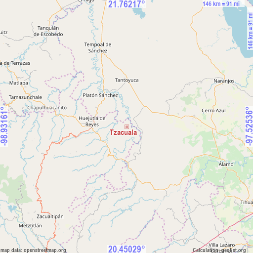
Tzacuala GPS coordinates[2]
21° 6' 27.648" North, 98° 13' 42.528" West
| Map corner | latitude | longitude |
|---|---|---|
| Upper-left | 21.76217°, | -98.93161° |
| Center: | 21.10768°, | -98.22848° |
| Lower-right: | 20.45029°, | -97.52536° |
| Map W x H: | 145.9×145.9 km | = 90.7×90.7mi |
| max Lat: | 32.7° ⇑22% North |
| Tzacuala: | 21.10768° |
| min Lat: | ⇓78% South 14.53588° |
| min Long | Tzacuala | max Long |
| -117.105° | -98.22848° | -86.73105° |
| W 60.8%⇐ | ⇒39.2% E |
Elevation
Elevation of Tzacuala is 215 m = 705 ft, and this is 1038.7 m = 3408 ft below average elevation for this country.
| Max E: |
3497 m = 11473 ft | 75.2% |
| Avg. | 1253.7 m = 4113 ft | |
| Tzacuala | 215 m = 705 ft | |
Min E: |
-1 m = -3 ft | 24.8% |
See also: Mexico elevation on elevation.city.
Geographical zone
Tzacuala is located in North Torrid zone (between Equator and Tropic of Cancer). Distance of this Northern Tropic circle is 259 km =160.9 mi to North.| Distance of | km | miles | from Tzacuala |
|---|---|---|---|
| North Pole | 7660.1 | 4759.8 | to North |
| Arctic Circle | 5054.2 | 3140.5 | to North |
| Tropic Cancer | 259 | 160.9 | to North |
| Equator | 2347 | 1458.4 | to South |


Nearby cities:
15 places around Tzacuala: (largest is in red/bold)
• Ahuehuetl
8.9 km =5.5 mi,  220°
220°
• Chalingo
1.3 km =0.8 mi,  136°
136°
• Chapopote Chico
3.8 km =2.4 mi,  328°
328°
• Congreso Permanente Agrario
7.9 km =4.9 mi,  292°
292°
• Huautla
10.5 km =6.5 mi, 215°
• Huazalinguillo
13 km =8.1 mi,  189°
189°
• Ixcanelco
5.1 km =3.2 mi,  46°
46°
• Los Ajos
12.9 km =8 mi,  42°
42°
• Los Otates
13.1 km =8.1 mi, 291°
• Los Puentes
11.5 km =7.1 mi,  229°
229°
• Pastoría
9.4 km =5.8 mi,  103°
103°
• Rancho Viejo
11.1 km =6.9 mi,  303°
303°
• San Diego
5.9 km =3.7 mi, 42°
• Tamoyón I
9.5 km =5.9 mi, 191°
• Tlacuapan
10.8 km =6.7 mi, 229°
Sources, notices
• [Note1] Compared only with cities in Mexico existing in our database
• [Src1] Map data: © OpenStreetMap contributors (CC-BY-SA)
• [Src2] Other city data from geonames.org with taken over terms of usage.
• [Src3] Geographical zone / Annual Mean Temperature by Robert A. Rohde @ Wikipedia
