Chapopote Chico geodata
Chapopote Chico (Veracruz) is a populated place; located in Mexico in America/Mexico_City (GMT-6) time zone. With population of 1,441 people, there are 5997 cities with bigger population in this country. Compared to other cities in Mexico, 78.4% of cities are located further ↓South; 60.6% of cities are located further ←West and 79.3% of cities have higher elevation than Chapopote Chico. Note1


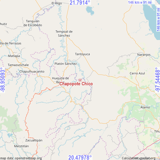
Chapopote Chico GPS coordinates[2]
21° 8' 13.344" North, 98° 14' 52.08" West
| Map corner | latitude | longitude |
|---|---|---|
| Upper-left | 21.7914°, | -98.95093° |
| Center: | 21.13704°, | -98.2478° |
| Lower-right: | 20.47978°, | -97.54468° |
| Map W x H: | 145.8×145.8 km | = 90.6×90.6mi |
| max Lat: | 32.7° ⇑21.6% North |
| Chapopote Chico: | 21.13704° |
| min Lat: | ⇓78.4% South 14.53588° |
| min Long | Chapopote Chico | max Long |
| -117.105° | -98.2478° | -86.73105° |
| W 60.6%⇐ | ⇒39.4% E |
Elevation
Elevation of Chapopote Chico is 106 m = 348 ft, and this is 1147.7 m = 3765 ft below average elevation for this country.
| Max E: |
3497 m = 11473 ft | 79.3% |
| Avg. | 1253.7 m = 4113 ft | |
| Chapopote Chico | 106 m = 348 ft | |
Min E: |
-1 m = -3 ft | 20.7% |
See also: Mexico elevation on elevation.city.
Geographical zone
Chapopote Chico is located in North Torrid zone (between Equator and Tropic of Cancer). Distance of this Northern Tropic circle is 255.7 km =158.9 mi to North.| Distance of | km | miles | from Chapopote Chico |
|---|---|---|---|
| North Pole | 7656.8 | 4757.7 | to North |
| Arctic Circle | 5051 | 3138.5 | to North |
| Tropic Cancer | 255.7 | 158.9 | to North |
| Equator | 2350.2 | 1460.3 | to South |


Nearby cities:
15 places around Chapopote Chico: (largest is in red/bold)
• Ahuehuetl
10.7 km =6.6 mi,  200°
200°
• Chalahuiyapa
12.2 km =7.6 mi,  277°
277°
• Chalingo
5.1 km =3.2 mi,  145°
145°
• Congreso Permanente Agrario
5.3 km =3.3 mi,  267°
267°
• El Mirador
11.5 km =7.1 mi,  23°
23°
• Huautla
12.5 km =7.8 mi, 198°
• Ixcanelco
5.7 km =3.5 mi,  87°
87°
• Los Ajos
12.4 km =7.7 mi,  59°
59°
• Los Otates
10.3 km =6.4 mi, 278°
• Pastoría
12.4 km =7.7 mi,  116°
116°
• Rancho Viejo
7.8 km =4.8 mi,  291°
291°
• San Diego
6 km =3.7 mi,  79°
79°
• Tamoyón I
12.5 km =7.8 mi,  179°
179°
• Tlacuapan
12 km =7.5 mi,  211°
211°
• Tzacuala
3.8 km =2.4 mi, 148°
Sources, notices
• [Note1] Compared only with cities in Mexico existing in our database
• [Src1] Map data: © OpenStreetMap contributors (CC-BY-SA)
• [Src2] Other city data from geonames.org with taken over terms of usage.
• [Src3] Geographical zone / Annual Mean Temperature by Robert A. Rohde @ Wikipedia
