Burgos geodata
Burgos (Tamaulipas) is a seat of a second-order administrative division; located in Mexico in America/Monterrey (GMT-6) time zone. With population of 1,404 people, there are 6168 cities with bigger population in this country. Compared to other cities in Mexico, 91.7% of cities are located further ↓South; 53.6% of cities are located further ←West and 76.6% of cities have higher elevation than Burgos. Note1


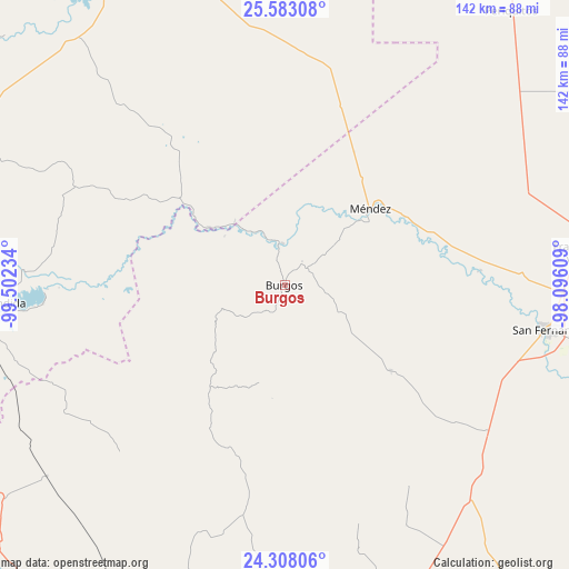
Burgos GPS coordinates[2]
24° 56' 49.992" North, 98° 47' 57.156" West
| Map corner | latitude | longitude |
|---|---|---|
| Upper-left | 25.58308°, | -99.50234° |
| Center: | 24.94722°, | -98.79921° |
| Lower-right: | 24.30806°, | -98.09609° |
| Map W x H: | 141.8×141.8 km | = 88.1×88.1mi |
| max Lat: | 32.7° ⇑8.3% North |
| Burgos: | 24.94722° |
| min Lat: | ⇓91.7% South 14.53588° |
| min Long | Burgos | max Long |
| -117.105° | -98.79921° | -86.73105° |
| W 53.6%⇐ | ⇒46.4% E |
Elevation
Elevation of Burgos is 167 m = 548 ft, and this is 1086.7 m = 3565 ft below average elevation for this country.
| Max E: |
3497 m = 11473 ft | 76.6% |
| Avg. | 1253.7 m = 4113 ft | |
| Burgos | 167 m = 548 ft | |
Min E: |
-1 m = -3 ft | 23.4% |
See also: Mexico elevation on elevation.city.
Geographical zone
Burgos is located in North temperate zone (between Tropic of Cancer and the Arctic Circle). Distance of this Northern Tropic circle is 168 km =104.4 mi to South.| Distance of | km | miles | from Burgos |
|---|---|---|---|
| North Pole | 7233.2 | 4494.5 | to North |
| Arctic Circle | 4627.3 | 2875.3 | to North |
| Tropic Cancer | 168 | 104.4 | to South |
| Equator | 2773.9 | 1723.6 | to South |


Nearby cities:
15 places around Burgos: (largest is in red/bold)
• Cruillas
33.9 km =21.1 mi,  128°
128°
• El Barranco Azul
68.8 km =42.8 mi,  207°
207°
• El Saucillo
60.8 km =37.8 mi,  216°
216°
• Emiliano Zapata (Ampliación San Germán)
76.7 km =47.7 mi,  78°
78°
• Garza Valdez
76.1 km =47.3 mi,  231°
231°
• General Lucio Blanco
65.3 km =40.6 mi,  248°
248°
• Guadalupe
68 km =42.3 mi,  265°
265°
• La Escondida
72.6 km =45.1 mi, 266°
• La Lomita
75 km =46.6 mi, 79°
• Linares
78.1 km =48.5 mi,  262°
262°
• Méndez
28.6 km =17.8 mi,  48°
48°
• Río Verde
75.2 km =46.7 mi, 266°
• San Carlos
43.1 km =26.8 mi,  199°
199°
• San Fernando
66.6 km =41.4 mi,  99°
99°
• San Nicolás
28.4 km =17.6 mi,  186°
186°
Sources, notices
• [Note1] Compared only with cities in Mexico existing in our database
• [Src1] Map data: © OpenStreetMap contributors (CC-BY-SA)
• [Src2] Other city data from geonames.org with taken over terms of usage.
• [Src3] Geographical zone / Annual Mean Temperature by Robert A. Rohde @ Wikipedia
