Atoyatempan geodata
Atoyatempan (Puebla) is a seat of a second-order administrative division; located in Mexico in America/Mexico_City (GMT-6) time zone. With population of 6,154 people, there are 1520 cities with bigger population in this country. Compared to other cities in Mexico, 68.4% of cities are located further ↑North; 64.7% of cities are located further ←West and 71.3% of cities have lower elevation than Atoyatempan. Note1


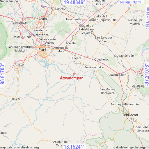
Atoyatempan GPS coordinates[2]
18° 49' 9.3" North, 97° 54' 50.04" West
| Map corner | latitude | longitude |
|---|---|---|
| Upper-left | 19.48346°, | -98.61703° |
| Center: | 18.81925°, | -97.9139° |
| Lower-right: | 18.15241°, | -97.21078° |
| Map W x H: | 148×148 km | = 92×92mi |
| max Lat: | 32.7° ⇑68.4% North |
| Atoyatempan: | 18.81925° |
| min Lat: | ⇓31.6% South 14.53588° |
| min Long | Atoyatempan | max Long |
| -117.105° | -97.9139° | -86.73105° |
| W 64.7%⇐ | ⇒35.3% E |
Elevation
Elevation of Atoyatempan is 1952 m = 6404 ft, and this is 698.3 m = 2291 ft above average elevation for this country.
| Max E: |
3497 m = 11473 ft | 28.7% |
| Atoyatempan | 1952 m 6404 ft | |
| Avg. | 1253.7 m = 4113 ft | |
Min E: |
-1 m = -3 ft | 71.3% |
See also: Mexico elevation on elevation.city.
Geographical zone
Atoyatempan is located in North Torrid zone (between Equator and Tropic of Cancer). Distance of this Northern Tropic circle is 513.4 km =319 mi to North.| Distance of | km | miles | from Atoyatempan |
|---|---|---|---|
| North Pole | 7914.6 | 4917.9 | to North |
| Arctic Circle | 5308.7 | 3298.7 | to North |
| Tropic Cancer | 513.4 | 319 | to North |
| Equator | 2092.5 | 1300.2 | to South |


Nearby cities:
15 places around Atoyatempan: (largest is in red/bold)
• Ahuatepec
4.4 km =2.7 mi,  354°
354°
• Concepción Cuautla
9.2 km =5.7 mi,  305°
305°
• Dolores Hidalgo
8.9 km =5.5 mi,  140°
140°
• Huacaltzingo
6 km =3.7 mi,  111°
111°
• Hueyotlipan
9.5 km =5.9 mi,  32°
32°
• La Magdalena Cuaxixtla
8.1 km =5 mi,  325°
325°
• Mixtla
9.7 km =6 mi,  11°
11°
• Ometepec
7.5 km =4.7 mi,  58°
58°
• San Antonio Juárez
8.5 km =5.3 mi,  250°
250°
• San Buenaventura
9.3 km =5.8 mi, 352°
• Santa Ana Coapan
2.7 km =1.7 mi, 60°
• Santa Clara Huitziltepec
6.6 km =4.1 mi,  148°
148°
• Tepeyahualco
3.9 km =2.4 mi,  98°
98°
• Tlanepantla
5.6 km =3.5 mi, 30°
• Zacaola
9.8 km =6.1 mi,  45°
45°
Sources, notices
• [Note1] Compared only with cities in Mexico existing in our database
• [Src1] Map data: © OpenStreetMap contributors (CC-BY-SA)
• [Src2] Other city data from geonames.org with taken over terms of usage.
• [Src3] Geographical zone / Annual Mean Temperature by Robert A. Rohde @ Wikipedia
