Carpinteros geodata
Carpinteros (Hidalgo) is a populated place; located in Mexico in America/Mexico_City (GMT-6) time zone. With population of 1,393 people, there are 6206 cities with bigger population in this country. Compared to other cities in Mexico, 69.7% of cities are located further ↓South; 56.8% of cities are located further ←West and 70.7% of cities have lower elevation than Carpinteros. Note1


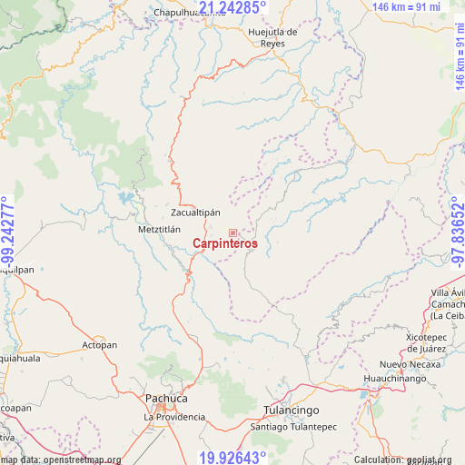
Carpinteros GPS coordinates[2]
20° 35' 9.816" North, 98° 32' 22.704" West
| Map corner | latitude | longitude |
|---|---|---|
| Upper-left | 21.24285°, | -99.24277° |
| Center: | 20.58606°, | -98.53964° |
| Lower-right: | 19.92643°, | -97.83652° |
| Map W x H: | 146.4×146.4 km | = 91×91mi |
| max Lat: | 32.7° ⇑30.3% North |
| Carpinteros: | 20.58606° |
| min Lat: | ⇓69.7% South 14.53588° |
| min Long | Carpinteros | max Long |
| -117.105° | -98.53964° | -86.73105° |
| W 56.8%⇐ | ⇒43.2% E |
Elevation
Elevation of Carpinteros is 1939 m = 6362 ft, and this is 685.3 m = 2248 ft above average elevation for this country.
| Max E: |
3497 m = 11473 ft | 29.3% |
| Carpinteros | 1939 m 6362 ft | |
| Avg. | 1253.7 m = 4113 ft | |
Min E: |
-1 m = -3 ft | 70.7% |
See also: Mexico elevation on elevation.city.
Geographical zone
Carpinteros is located in North Torrid zone (between Equator and Tropic of Cancer). Distance of this Northern Tropic circle is 317 km =197 mi to North.| Distance of | km | miles | from Carpinteros |
|---|---|---|---|
| North Pole | 7718.1 | 4795.8 | to North |
| Arctic Circle | 5112.2 | 3176.6 | to North |
| Tropic Cancer | 317 | 197 | to North |
| Equator | 2289 | 1422.3 | to South |


Nearby cities:
15 places around Carpinteros: (largest is in red/bold)
• Atecoxco
10 km =6.2 mi,  210°
210°
• Atopixco
7.2 km =4.5 mi,  283°
283°
• Coatlila
12.2 km =7.6 mi,  336°
336°
• Huayacocotla
8.2 km =5.1 mi,  131°
131°
• Jalapa
10 km =6.2 mi,  14°
14°
• La Mojonera
9.5 km =5.9 mi,  297°
297°
• La Selva
4.2 km =2.6 mi,  119°
119°
• Mezquititlán
11.8 km =7.3 mi,  239°
239°
• San Pablo Mitecatlán
13.6 km =8.5 mi, 7°
• Tizapán
9.5 km =5.9 mi,  320°
320°
• Tlahuelompa (San Francisco Tlahuelompa)
8.1 km =5 mi,  332°
332°
• Tuzanapa
4.7 km =2.9 mi,  261°
261°
• Xoxoteco
11.9 km =7.4 mi,  228°
228°
• Zacualtipán
14.1 km =8.8 mi, 300°
• Zilacatipan
13.8 km =8.6 mi,  55°
55°
Sources, notices
• [Note1] Compared only with cities in Mexico existing in our database
• [Src1] Map data: © OpenStreetMap contributors (CC-BY-SA)
• [Src2] Other city data from geonames.org with taken over terms of usage.
• [Src3] Geographical zone / Annual Mean Temperature by Robert A. Rohde @ Wikipedia
