Tula geodata
Tula (Puebla) is a populated place; located in Mexico in America/Mexico_City (GMT-6) time zone. With population of 1,059 people, there are 8240 cities with bigger population in this country. Compared to other cities in Mexico, 72.1% of cities are located further ↑North; 64.7% of cities are located further ←West and 65.4% of cities have lower elevation than Tula. Note1


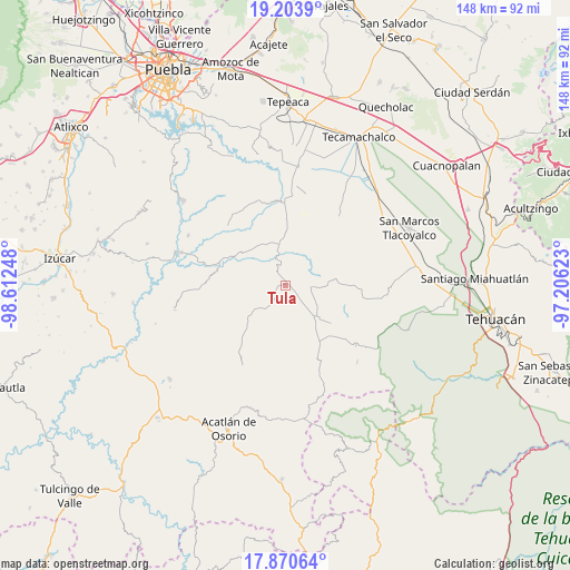
Tula GPS coordinates[2]
18° 32' 18.852" North, 97° 54' 33.66" West
| Map corner | latitude | longitude |
|---|---|---|
| Upper-left | 19.2039°, | -98.61248° |
| Center: | 18.53857°, | -97.90935° |
| Lower-right: | 17.87064°, | -97.20623° |
| Map W x H: | 148.2×148.2 km | = 92.1×92.1mi |
| max Lat: | 32.7° ⇑72.1% North |
| Tula: | 18.53857° |
| min Lat: | ⇓27.9% South 14.53588° |
| min Long | Tula | max Long |
| -117.105° | -97.90935° | -86.73105° |
| W 64.7%⇐ | ⇒35.3% E |
Elevation
Elevation of Tula is 1839 m = 6033 ft, and this is 585.3 m = 1920 ft above average elevation for this country.
| Max E: |
3497 m = 11473 ft | 34.6% |
| Tula | 1839 m 6033 ft | |
| Avg. | 1253.7 m = 4113 ft | |
Min E: |
-1 m = -3 ft | 65.4% |
See also: Mexico elevation on elevation.city.
Geographical zone
Tula is located in North Torrid zone (between Equator and Tropic of Cancer). Distance of this Northern Tropic circle is 544.6 km =338.4 mi to North.| Distance of | km | miles | from Tula |
|---|---|---|---|
| North Pole | 7945.8 | 4937.3 | to North |
| Arctic Circle | 5339.9 | 3318.1 | to North |
| Tropic Cancer | 544.6 | 338.4 | to North |
| Equator | 2061.3 | 1280.8 | to South |


Nearby cities:
15 places around Tula: (largest is in red/bold)
• Agua Santa Ana
5.5 km =3.4 mi,  242°
242°
• Almolonga
9 km =5.6 mi,  219°
219°
• Chapultepec (Santo Domingo)
10.3 km =6.4 mi, 236°
• Colonia Morelos (Pie de Vaca)
6.4 km =4 mi,  353°
353°
• El Progreso
6 km =3.7 mi,  65°
65°
• El Rosario Xochitiopan
12.1 km =7.5 mi,  335°
335°
• Guadalupe Victoria
6.8 km =4.2 mi,  91°
91°
• Huajoyuca
4.1 km =2.5 mi,  225°
225°
• Huejonapan
7.8 km =4.8 mi,  189°
189°
• Mariscala
2.5 km =1.6 mi,  201°
201°
• Moralillo
3.8 km =2.4 mi,  286°
286°
• San José de Gracia
13.4 km =8.3 mi,  29°
29°
• San Juan Ixcaquixtla
12 km =7.5 mi,  136°
136°
• Tepexi de Rodríguez
5 km =3.1 mi, 339°
• Victoria
13.3 km =8.3 mi, 345°
Sources, notices
• [Note1] Compared only with cities in Mexico existing in our database
• [Src1] Map data: © OpenStreetMap contributors (CC-BY-SA)
• [Src2] Other city data from geonames.org with taken over terms of usage.
• [Src3] Geographical zone / Annual Mean Temperature by Robert A. Rohde @ Wikipedia
