San Juan Ixcaquixtla geodata
San Juan Ixcaquixtla (Puebla) is a populated place; located in Mexico in America/Mexico_City (GMT-6) time zone. With population of 4,922 people, there are 1877 cities with bigger population in this country. Compared to other cities in Mexico, 73.1% of cities are located further ↑North; 65.7% of cities are located further ←West and 69.3% of cities have lower elevation than San Juan Ixcaquixtla. Note1
Current local time in San Juan Ixcaquixtla:
08:44 AM, WednesdayDifference from your time zone: hours


San Juan Ixcaquixtla GPS coordinates[2]
18° 27' 38.412" North, 97° 49' 51.708" West
| Map corner | latitude | longitude |
|---|---|---|
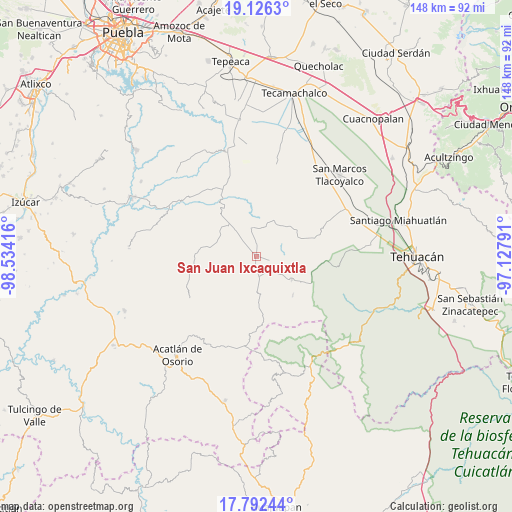
| Upper-left | 19.1263°, | -98.53416° |
| Center: | 18.46067°, | -97.83103° |
| Lower-right: | 17.79244°, | -97.12791° |
| Map W x H: | 148.3×148.3 km | = 92.1×92.1mi |
| max Lat: | 32.7° ⇑73.1% North |
| San Juan Ixcaquixtla: | 18.46067° |
| min Lat: | ⇓26.9% South 14.53588° |
| min Long | San Juan Ixcaqu | max Long |
| -117.105° | -97.83103° | -86.73105° |
| W 65.7%⇐ | ⇒34.3% E |
Elevation
Elevation of San Juan Ixcaquixtla is 1913 m = 6276 ft, and this is 659.3 m = 2163 ft above average elevation for this country.
| Max E: |
3497 m = 11473 ft | 30.7% |
| San Juan Ixcaquixtla | 1913 m 6276 ft | |
| Avg. | 1253.7 m = 4113 ft | |
Min E: |
-1 m = -3 ft | 69.3% |
See also: Mexico elevation on elevation.city.
Geographical zone
San Juan Ixcaquixtla is located in North Torrid zone (between Equator and Tropic of Cancer). Distance of this Northern Tropic circle is 553.3 km =343.8 mi to North.| Distance of | km | miles | from San Juan Ixcaquixtla |
|---|---|---|---|
| North Pole | 7954.4 | 4942.6 | to North |
| Arctic Circle | 5348.5 | 3323.4 | to North |
| Tropic Cancer | 553.3 | 343.8 | to North |
| Equator | 2052.6 | 1275.4 | to South |


Nearby cities:
15 places around San Juan Ixcaquixtla: (largest is in red/bold)
• Agua Santa Ana
14.5 km =9 mi,  295°
295°
• Almolonga
14.1 km =8.8 mi,  277°
277°
• Atexcal
12.2 km =7.6 mi,  123°
123°
• El Progreso
11.4 km =7.1 mi,  345°
345°
• Guadalupe Victoria
8.6 km =5.3 mi, 350°
• Huajoyuca
12.6 km =7.8 mi, 297°
• Huejonapan
9.6 km =6 mi, 276°
• Juan N. Méndez
11.1 km =6.9 mi,  34°
34°
• Magdalena Alquizapán
7.8 km =4.8 mi,  72°
72°
• Mariscala
11.2 km =7 mi, 304°
• Moralillo
15.4 km =9.6 mi,  309°
309°
• San Felipe Otlaltepec
10.4 km =6.5 mi,  230°
230°
• San Mateo Zoyamazalco
5.5 km =3.4 mi,  142°
142°
• San Vicente Coyotepec
6.3 km =3.9 mi,  178°
178°
• Tula
12 km =7.5 mi,  316°
316°
Sources, notices
• [Note1] Compared only with cities in Mexico existing in our database
• [Src1] Map data: © OpenStreetMap contributors (CC-BY-SA)
• [Src2] Other city data from geonames.org with taken over terms of usage.
• [Src3] Geographical zone / Annual Mean Temperature by Robert A. Rohde @ Wikipedia
