Jalpa geodata
Jalpa (Hidalgo) is a populated place; located in Mexico in America/Mexico_City (GMT-6) time zone. With population of 1,228 people, there are 7063 cities with bigger population in this country. Compared to other cities in Mexico, 78% of cities are located further ↓South; 54.9% of cities are located further ←West and 74.1% of cities have higher elevation than Jalpa. Note1


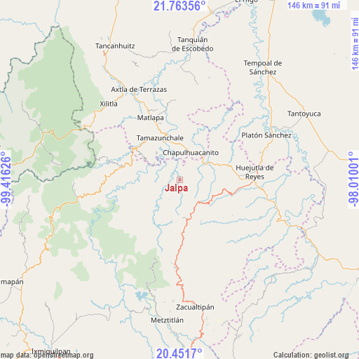
Jalpa GPS coordinates[2]
21° 6' 32.688" North, 98° 42' 47.268" West
| Map corner | latitude | longitude |
|---|---|---|
| Upper-left | 21.76356°, | -99.41626° |
| Center: | 21.10908°, | -98.71313° |
| Lower-right: | 20.4517°, | -98.01001° |
| Map W x H: | 145.9×145.9 km | = 90.7×90.7mi |
| max Lat: | 32.7° ⇑22% North |
| Jalpa: | 21.10908° |
| min Lat: | ⇓78% South 14.53588° |
| min Long | Jalpa | max Long |
| -117.105° | -98.71313° | -86.73105° |
| W 54.9%⇐ | ⇒45.1% E |
Elevation
Elevation of Jalpa is 250 m = 820 ft, and this is 1003.7 m = 3293 ft below average elevation for this country.
| Max E: |
3497 m = 11473 ft | 74.1% |
| Avg. | 1253.7 m = 4113 ft | |
| Jalpa | 250 m = 820 ft | |
Min E: |
-1 m = -3 ft | 25.9% |
See also: Mexico elevation on elevation.city.
Geographical zone
Jalpa is located in North Torrid zone (between Equator and Tropic of Cancer). Distance of this Northern Tropic circle is 258.8 km =160.8 mi to North.| Distance of | km | miles | from Jalpa |
|---|---|---|---|
| North Pole | 7660 | 4759.7 | to North |
| Arctic Circle | 5054.1 | 3140.5 | to North |
| Tropic Cancer | 258.8 | 160.8 | to North |
| Equator | 2347.1 | 1458.4 | to South |


Nearby cities:
15 places around Jalpa: (largest is in red/bold)
• Acoyotla
6.9 km =4.3 mi,  285°
285°
• Ahuatitla
7.9 km =4.9 mi,  38°
38°
• Chantasco
7.7 km =4.8 mi,  330°
330°
• Cuatlimax
5.4 km =3.4 mi,  103°
103°
• Hueyapa
3.7 km =2.3 mi,  136°
136°
• Huitepec
6.2 km =3.9 mi,  189°
189°
• Huitzitzilingo
9.2 km =5.7 mi, 39°
• Pahuayo
7.3 km =4.5 mi,  5°
5°
• Pueblo Hidalgo
3.7 km =2.3 mi,  80°
80°
• Santa Lucía
6 km =3.7 mi, 6°
• Talol
9.1 km =5.7 mi, 82°
• Temango
3.4 km =2.1 mi, 43°
• Tianguispicula
9.1 km =5.7 mi,  4°
4°
• Xalcuatla
9.7 km =6 mi, 328°
• Xuchitlán
6 km =3.7 mi,  212°
212°
Sources, notices
• [Note1] Compared only with cities in Mexico existing in our database
• [Src1] Map data: © OpenStreetMap contributors (CC-BY-SA)
• [Src2] Other city data from geonames.org with taken over terms of usage.
• [Src3] Geographical zone / Annual Mean Temperature by Robert A. Rohde @ Wikipedia
