El Frutillo geodata
El Frutillo (Oaxaca) is a populated place; located in Mexico in America/Mexico_City (GMT-6) time zone. With population of 520 people, there are 16208 cities with bigger population in this country. Compared to other cities in Mexico, 94.4% of cities are located further ↑North; 66.4% of cities are located further ←West and 68.3% of cities have higher elevation than El Frutillo. Note1


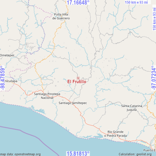
El Frutillo GPS coordinates[2]
16° 29' 36.528" North, 97° 46' 31.656" West
| Map corner | latitude | longitude |
|---|---|---|
| Upper-left | 17.16648°, | -98.47859° |
| Center: | 16.49348°, | -97.77546° |
| Lower-right: | 15.81813°, | -97.07234° |
| Map W x H: | 149.9×149.9 km | = 93.1×93.1mi |
| max Lat: | 32.7° ⇑94.4% North |
| El Frutillo: | 16.49348° |
| min Lat: | ⇓5.6% South 14.53588° |
| min Long | El Frutillo | max Long |
| -117.105° | -97.77546° | -86.73105° |
| W 66.4%⇐ | ⇒33.6% E |
Elevation
Elevation of El Frutillo is 508 m = 1667 ft, and this is 745.7 m = 2447 ft below average elevation for this country.
| Max E: |
3497 m = 11473 ft | 68.3% |
| Avg. | 1253.7 m = 4113 ft | |
| El Frutillo | 508 m = 1667 ft | |
Min E: |
-1 m = -3 ft | 31.7% |
See also: Mexico elevation on elevation.city.
Geographical zone
El Frutillo is located in North Torrid zone (between Equator and Tropic of Cancer). Distance of this Northern Tropic circle is 772 km =479.7 mi to North.| Distance of | km | miles | from El Frutillo |
|---|---|---|---|
| North Pole | 8173.2 | 5078.6 | to North |
| Arctic Circle | 5567.3 | 3459.4 | to North |
| Tropic Cancer | 772 | 479.7 | to North |
| Equator | 1833.9 | 1139.5 | to South |


Nearby cities:
15 places around El Frutillo: (largest is in red/bold)
• El Carasol
2.3 km =1.4 mi,  345°
345°
• El Mosco
13.9 km =8.6 mi,  67°
67°
• La Humedad
15.2 km =9.4 mi,  49°
49°
• La Muralla
7 km =4.3 mi,  269°
269°
• Llano Verde
11.8 km =7.3 mi,  58°
58°
• Nuevo Progreso
13 km =8.1 mi,  283°
283°
• San Agustín Chayuco
10.7 km =6.6 mi,  199°
199°
• San Cristóbal
9.7 km =6 mi,  263°
263°
• San José de las Flores
10.7 km =6.6 mi,  161°
161°
• San Juan Yosocani
14.9 km =9.3 mi,  243°
243°
• San Lorenzo
15.2 km =9.4 mi,  223°
223°
• Santa María Nutío
13.7 km =8.5 mi, 266°
• Santa María Yosocani
12.2 km =7.6 mi,  234°
234°
• Santiago Ixtayutla
15.4 km =9.6 mi, 58°
• Villa Nueva
9.2 km =5.7 mi,  325°
325°
Sources, notices
• [Note1] Compared only with cities in Mexico existing in our database
• [Src1] Map data: © OpenStreetMap contributors (CC-BY-SA)
• [Src2] Other city data from geonames.org with taken over terms of usage.
• [Src3] Geographical zone / Annual Mean Temperature by Robert A. Rohde @ Wikipedia
