El Carasol geodata
El Carasol (Oaxaca) is a populated place; located in Mexico in America/Mexico_City (GMT-6) time zone. With population of 707 people, there are 12307 cities with bigger population in this country. Compared to other cities in Mexico, 94.2% of cities are located further ↑North; 66.4% of cities are located further ←West and 63.2% of cities have higher elevation than El Carasol. Note1


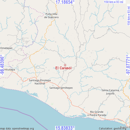
El Carasol GPS coordinates[2]
16° 30' 48.996" North, 97° 46' 50.988" West
| Map corner | latitude | longitude |
|---|---|---|
| Upper-left | 17.18654°, | -98.48396° |
| Center: | 16.51361°, | -97.78083° |
| Lower-right: | 15.83833°, | -97.07771° |
| Map W x H: | 149.9×149.9 km | = 93.1×93.1mi |
| max Lat: | 32.7° ⇑94.2% North |
| El Carasol: | 16.51361° |
| min Lat: | ⇓5.8% South 14.53588° |
| min Long | El Carasol | max Long |
| -117.105° | -97.78083° | -86.73105° |
| W 66.4%⇐ | ⇒33.6% E |
Elevation
Elevation of El Carasol is 805 m = 2641 ft, and this is 448.7 m = 1472 ft below average elevation for this country.
| Max E: |
3497 m = 11473 ft | 63.2% |
| Avg. | 1253.7 m = 4113 ft | |
| El Carasol | 805 m = 2641 ft | |
Min E: |
-1 m = -3 ft | 36.8% |
See also: Mexico elevation on elevation.city.
Geographical zone
El Carasol is located in North Torrid zone (between Equator and Tropic of Cancer). Distance of this Northern Tropic circle is 769.8 km =478.3 mi to North.| Distance of | km | miles | from El Carasol |
|---|---|---|---|
| North Pole | 8170.9 | 5077.2 | to North |
| Arctic Circle | 5565 | 3457.9 | to North |
| Tropic Cancer | 769.8 | 478.3 | to North |
| Equator | 1836.1 | 1140.9 | to South |


Nearby cities:
15 places around El Carasol: (largest is in red/bold)
• El Frutillo
2.3 km =1.4 mi,  165°
165°
• El Mosco
13.7 km =8.5 mi,  76°
76°
• La Humedad
14.3 km =8.9 mi,  57°
57°
• La Muralla
6.8 km =4.2 mi,  249°
249°
• La Reforma
14.1 km =8.8 mi,  330°
330°
• Llano Verde
11.4 km =7.1 mi,  69°
69°
• Nuevo Progreso
12.1 km =7.5 mi,  274°
274°
• San Agustín Chayuco
12.7 km =7.9 mi,  193°
193°
• San Cristóbal
9.6 km =6 mi, 250°
• San José de las Flores
13 km =8.1 mi,  161°
161°
• San Juan Yosocani
15.5 km =9.6 mi,  235°
235°
• Santa María Nutío
13.5 km =8.4 mi,  256°
256°
• Santa María Yosocani
13.2 km =8.2 mi,  225°
225°
• Santiago Ixtayutla
14.9 km =9.3 mi, 66°
• Villa Nueva
7 km =4.3 mi,  319°
319°
Sources, notices
• [Note1] Compared only with cities in Mexico existing in our database
• [Src1] Map data: © OpenStreetMap contributors (CC-BY-SA)
• [Src2] Other city data from geonames.org with taken over terms of usage.
• [Src3] Geographical zone / Annual Mean Temperature by Robert A. Rohde @ Wikipedia
