Nuevo Progreso geodata
Nuevo Progreso (Oaxaca) is a populated place; located in Mexico in America/Mexico_City (GMT-6) time zone. With population of 811 people, there are 10778 cities with bigger population in this country. Compared to other cities in Mexico, 94.2% of cities are located further ↑North; 64.9% of cities are located further ←West and 68.2% of cities have higher elevation than Nuevo Progreso. Note1


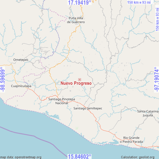
Nuevo Progreso GPS coordinates[2]
16° 31' 16.608" North, 97° 53' 37.896" West
| Map corner | latitude | longitude |
|---|---|---|
| Upper-left | 17.19419°, | -98.59699° |
| Center: | 16.52128°, | -97.89386° |
| Lower-right: | 15.84602°, | -97.19074° |
| Map W x H: | 149.9×149.9 km | = 93.1×93.1mi |
| max Lat: | 32.7° ⇑94.2% North |
| Nuevo Progreso: | 16.52128° |
| min Lat: | ⇓5.8% South 14.53588° |
| min Long | Nuevo Progreso | max Long |
| -117.105° | -97.89386° | -86.73105° |
| W 64.9%⇐ | ⇒35.1% E |
Elevation
Elevation of Nuevo Progreso is 520 m = 1706 ft, and this is 733.7 m = 2407 ft below average elevation for this country.
| Max E: |
3497 m = 11473 ft | 68.2% |
| Avg. | 1253.7 m = 4113 ft | |
| Nuevo Progreso | 520 m = 1706 ft | |
Min E: |
-1 m = -3 ft | 31.8% |
See also: Mexico elevation on elevation.city.
Geographical zone
Nuevo Progreso is located in North Torrid zone (between Equator and Tropic of Cancer). Distance of this Northern Tropic circle is 768.9 km =477.8 mi to North.| Distance of | km | miles | from Nuevo Progreso |
|---|---|---|---|
| North Pole | 8170.1 | 5076.7 | to North |
| Arctic Circle | 5564.2 | 3457.4 | to North |
| Tropic Cancer | 768.9 | 477.8 | to North |
| Equator | 1837 | 1141.5 | to South |


Nearby cities:
15 places around Nuevo Progreso: (largest is in red/bold)
• El Carasol
12.1 km =7.5 mi,  94°
94°
• El Frutillo
13 km =8.1 mi,  103°
103°
• La Muralla
6.5 km =4 mi,  119°
119°
• La Reforma
12.5 km =7.8 mi,  24°
24°
• San Cristóbal
5.1 km =3.2 mi,  144°
144°
• San Juan Colorado
9.3 km =5.8 mi,  223°
223°
• San Juan Jicayán
13.6 km =8.5 mi,  248°
248°
• San Juan Yosocani
9.7 km =6 mi,  184°
184°
• San Miguel Tetepelcingo
13.7 km =8.5 mi, 183°
• San Pedro Atoyac
10.4 km =6.5 mi, 250°
• Santa María Nutío
4.1 km =2.5 mi,  195°
195°
• Santa María Yosocani
10.5 km =6.5 mi,  165°
165°
• Santiago Jicayán
13.3 km =8.3 mi, 249°
• Siniyuvi
6.2 km =3.9 mi, 215°
• Villa Nueva
8.7 km =5.4 mi,  59°
59°
Sources, notices
• [Note1] Compared only with cities in Mexico existing in our database
• [Src1] Map data: © OpenStreetMap contributors (CC-BY-SA)
• [Src2] Other city data from geonames.org with taken over terms of usage.
• [Src3] Geographical zone / Annual Mean Temperature by Robert A. Rohde @ Wikipedia
