Monte Grande geodata
Monte Grande (Tabasco) is a populated place; located in Mexico in America/Mexico_City (GMT-6) time zone. With population of 1,810 people, there are 4809 cities with bigger population in this country. Compared to other cities in Mexico, 79.3% of cities are located further ↑North; 93.6% of cities are located further ←West and 99.1% of cities have higher elevation than Monte Grande. Note1


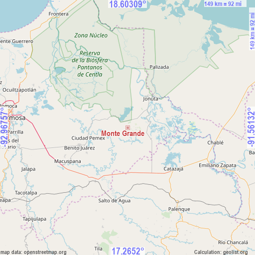
Monte Grande GPS coordinates[2]
17° 56' 7.476" North, 92° 15' 51.984" West
| Map corner | latitude | longitude |
|---|---|---|
| Upper-left | 18.60309°, | -92.96757° |
| Center: | 17.93541°, | -92.26444° |
| Lower-right: | 17.2652°, | -91.56132° |
| Map W x H: | 148.8×148.8 km | = 92.5×92.5mi |
| max Lat: | 32.7° ⇑79.3% North |
| Monte Grande: | 17.93541° |
| min Lat: | ⇓20.7% South 14.53588° |
| min Long | Monte Grande | max Long |
| -117.105° | -92.26444° | -86.73105° |
| W 93.6%⇐ | ⇒6.4% E |
Elevation
Elevation of Monte Grande is 6 m = 20 ft, and this is 1247.7 m = 4094 ft below average elevation for this country.
| Max E: |
3497 m = 11473 ft | 99.1% |
| Avg. | 1253.7 m = 4113 ft | |
| Monte Grande | 6 m = 20 ft | |
Min E: |
-1 m = -3 ft | 0.9% |
See also: Mexico elevation on elevation.city.
Geographical zone
Monte Grande is located in North Torrid zone (between Equator and Tropic of Cancer). Distance of this Northern Tropic circle is 611.7 km =380.1 mi to North.| Distance of | km | miles | from Monte Grande |
|---|---|---|---|
| North Pole | 8012.8 | 4978.9 | to North |
| Arctic Circle | 5406.9 | 3359.7 | to North |
| Tropic Cancer | 611.7 | 380.1 | to North |
| Equator | 1994.2 | 1239.1 | to South |


Nearby cities:
15 places around Monte Grande: (largest is in red/bold)
• Alcalde Mayor
24.8 km =15.4 mi,  191°
191°
• Aquiles Serdán
17 km =10.6 mi, 186°
• Ciudad Pemex
24 km =14.9 mi,  255°
255°
• El Bayo 2da. Sección
23.4 km =14.5 mi,  252°
252°
• El Congo
22.2 km =13.8 mi,  236°
236°
• El Rosario
22.6 km =14 mi,  129°
129°
• Hermenegildo Galeana (Chiveros)
22.3 km =13.9 mi, 254°
• Jonuta
21.8 km =13.5 mi,  37°
37°
• José Colomo
21.4 km =13.3 mi,  273°
273°
• La Curva
24.9 km =15.5 mi, 251°
• Los Pájaros
20 km =12.4 mi,  98°
98°
• Ramón Grande
13.2 km =8.2 mi,  177°
177°
• Sacrificio
21.1 km =13.1 mi, 39°
• Tepetitán
17.2 km =10.7 mi,  221°
221°
• Venustiano Carranza
17.8 km =11.1 mi,  172°
172°
Sources, notices
• [Note1] Compared only with cities in Mexico existing in our database
• [Src1] Map data: © OpenStreetMap contributors (CC-BY-SA)
• [Src2] Other city data from geonames.org with taken over terms of usage.
• [Src3] Geographical zone / Annual Mean Temperature by Robert A. Rohde @ Wikipedia
