San Pedro geodata
San Pedro (Hidalgo) is a populated place; located in Mexico in America/Mexico_City (GMT-6) time zone. With population of 516 people, there are 16314 cities with bigger population in this country. Compared to other cities in Mexico, 70.2% of cities are located further ↓South; 57.1% of cities are located further →East and 66.7% of cities have lower elevation than San Pedro. Note1


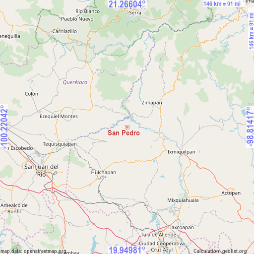
San Pedro GPS coordinates[2]
20° 36' 33.66" North, 99° 31' 2.244" West
| Map corner | latitude | longitude |
|---|---|---|
| Upper-left | 21.26604°, | -100.22042° |
| Center: | 20.60935°, | -99.51729° |
| Lower-right: | 19.94981°, | -98.81417° |
| Map W x H: | 146.4×146.4 km | = 91×91mi |
| max Lat: | 32.7° ⇑29.8% North |
| San Pedro: | 20.60935° |
| min Lat: | ⇓70.2% South 14.53588° |
| min Long | San Pedro | max Long |
| -117.105° | -99.51729° | -86.73105° |
| W 42.9%⇐ | ⇒57.1% E |
Elevation
Elevation of San Pedro is 1863 m = 6112 ft, and this is 609.3 m = 1999 ft above average elevation for this country.
| Max E: |
3497 m = 11473 ft | 33.3% |
| San Pedro | 1863 m 6112 ft | |
| Avg. | 1253.7 m = 4113 ft | |
Min E: |
-1 m = -3 ft | 66.7% |
See also: Mexico elevation on elevation.city.
Geographical zone
San Pedro is located in North Torrid zone (between Equator and Tropic of Cancer). Distance of this Northern Tropic circle is 314.4 km =195.4 mi to North.| Distance of | km | miles | from San Pedro |
|---|---|---|---|
| North Pole | 7715.5 | 4794.2 | to North |
| Arctic Circle | 5109.6 | 3175 | to North |
| Tropic Cancer | 314.4 | 195.4 | to North |
| Equator | 2291.5 | 1423.9 | to South |


Nearby cities:
15 places around San Pedro: (largest is in red/bold)
• Apartadero
12.5 km =7.8 mi,  198°
198°
• Banzha
7.6 km =4.7 mi,  252°
252°
• Bella Vista del Río
10.6 km =6.6 mi,  327°
327°
• Bomanxotha
18.7 km =11.6 mi,  236°
236°
• Boyecito
17.5 km =10.9 mi,  262°
262°
• Caltimacan
17.3 km =10.7 mi,  117°
117°
• Cerro Prieto
17 km =10.6 mi,  308°
308°
• El Riíto
12.3 km =7.6 mi, 252°
• Gandhó
19.1 km =11.9 mi, 248°
• San Antonio Tezoquipan
15.8 km =9.8 mi,  161°
161°
• San Miguel Caltepantla
17.9 km =11.1 mi,  217°
217°
• Tecozautla
14.8 km =9.2 mi, 235°
• Tenzabhí
17.1 km =10.6 mi,  227°
227°
• Uxdejhé
15.9 km =9.9 mi, 258°
• Álvaro Obregón
18.5 km =11.5 mi,  54°
54°
Sources, notices
• [Note1] Compared only with cities in Mexico existing in our database
• [Src1] Map data: © OpenStreetMap contributors (CC-BY-SA)
• [Src2] Other city data from geonames.org with taken over terms of usage.
• [Src3] Geographical zone / Annual Mean Temperature by Robert A. Rohde @ Wikipedia
