Santa Úrsula geodata
Santa Úrsula (Hidalgo) is a populated place; located in Mexico in America/Mexico_City (GMT-6) time zone. With population of 1,253 people, there are 6913 cities with bigger population in this country. Compared to other cities in Mexico, 66.1% of cities are located further ↓South; 62.4% of cities are located further ←West and 61% of cities have higher elevation than Santa Úrsula. Note1


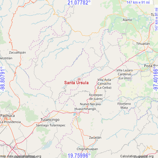
Santa Úrsula GPS coordinates[2]
20° 25' 13.08" North, 98° 6' 17.208" West
| Map corner | latitude | longitude |
|---|---|---|
| Upper-left | 21.07782°, | -98.80791° |
| Center: | 20.4203°, | -98.10478° |
| Lower-right: | 19.75996°, | -97.40166° |
| Map W x H: | 146.5×146.5 km | = 91×91mi |
| max Lat: | 32.7° ⇑33.9% North |
| Santa Úrsula: | 20.4203° |
| min Lat: | ⇓66.1% South 14.53588° |
| min Long | Santa Úrsula | max Long |
| -117.105° | -98.10478° | -86.73105° |
| W 62.4%⇐ | ⇒37.6% E |
Elevation
Elevation of Santa Úrsula is 937 m = 3074 ft, and this is 316.7 m = 1039 ft below average elevation for this country.
| Max E: |
3497 m = 11473 ft | 61% |
| Avg. | 1253.7 m = 4113 ft | |
| Santa Úrsula | 937 m = 3074 ft | |
Min E: |
-1 m = -3 ft | 39% |
See also: Mexico elevation on elevation.city.
Geographical zone
Santa Úrsula is located in North Torrid zone (between Equator and Tropic of Cancer). Distance of this Northern Tropic circle is 335.4 km =208.4 mi to North.| Distance of | km | miles | from Santa Úrsula |
|---|---|---|---|
| North Pole | 7736.5 | 4807.2 | to North |
| Arctic Circle | 5130.6 | 3188 | to North |
| Tropic Cancer | 335.4 | 208.4 | to North |
| Equator | 2270.5 | 1410.8 | to South |


Nearby cities:
15 places around Santa Úrsula: (largest is in red/bold)
• Acalmán
4.8 km =3 mi,  88°
88°
• Barrio Aztlán
5.4 km =3.4 mi,  21°
21°
• Colonia Industrial
9.6 km =6 mi,  260°
260°
• Cuaxtla
6.2 km =3.9 mi,  147°
147°
• El Ocotal
2.7 km =1.7 mi,  155°
155°
• El Álamo
8.3 km =5.2 mi,  127°
127°
• Huehuetla
5.4 km =3.4 mi,  33°
33°
• San Andrés
9.2 km =5.7 mi,  5°
5°
• San Antonio el Grande
8.3 km =5.2 mi,  60°
60°
• San Bartolo Tutotepec
10.3 km =6.4 mi, 256°
• San Clemente
4.7 km =2.9 mi,  248°
248°
• San Pablo el Grande
8.7 km =5.4 mi,  221°
221°
• Santa Inés
4.2 km =2.6 mi, 20°
• Tlaxco
7.9 km =4.9 mi, 87°
• Valle Verde
9.7 km =6 mi, 257°
Sources, notices
• [Note1] Compared only with cities in Mexico existing in our database
• [Src1] Map data: © OpenStreetMap contributors (CC-BY-SA)
• [Src2] Other city data from geonames.org with taken over terms of usage.
• [Src3] Geographical zone / Annual Mean Temperature by Robert A. Rohde @ Wikipedia
