San Antonio el Grande geodata
San Antonio el Grande (Hidalgo) is a populated place; located in Mexico in America/Mexico_City (GMT-6) time zone. With population of 2,284 people, there are 3855 cities with bigger population in this country. Compared to other cities in Mexico, 66.9% of cities are located further ↓South; 63.2% of cities are located further ←West and 63.6% of cities have higher elevation than San Antonio el Grande. Note1
Current local time in San Antonio el Grande:
08:28 AM, WednesdayDifference from your time zone: hours


San Antonio el Grande GPS coordinates[2]
20° 27' 24.588" North, 98° 2' 5.424" West
| Map corner | latitude | longitude |
|---|---|---|
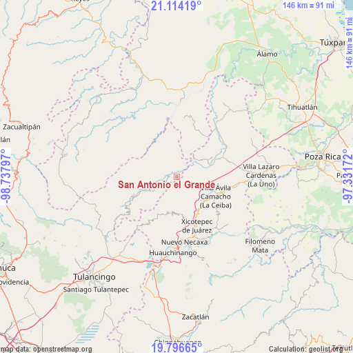
| Upper-left | 21.11419°, | -98.73797° |
| Center: | 20.45683°, | -98.03484° |
| Lower-right: | 19.79665°, | -97.33172° |
| Map W x H: | 146.5×146.5 km | = 91×91mi |
| max Lat: | 32.7° ⇑33.1% North |
| San Antonio el Grande: | 20.45683° |
| min Lat: | ⇓66.9% South 14.53588° |
| min Long | San Antonio el | max Long |
| -117.105° | -98.03484° | -86.73105° |
| W 63.2%⇐ | ⇒36.8% E |
Elevation
Elevation of San Antonio el Grande is 780 m = 2559 ft, and this is 473.7 m = 1554 ft below average elevation for this country.
| Max E: |
3497 m = 11473 ft | 63.6% |
| Avg. | 1253.7 m = 4113 ft | |
| San Antonio el Grande | 780 m = 2559 ft | |
Min E: |
-1 m = -3 ft | 36.4% |
See also: Mexico elevation on elevation.city.
Geographical zone
San Antonio el Grande is located in North Torrid zone (between Equator and Tropic of Cancer). Distance of this Northern Tropic circle is 331.3 km =205.9 mi to North.| Distance of | km | miles | from San Antonio el Grande |
|---|---|---|---|
| North Pole | 7732.5 | 4804.8 | to North |
| Arctic Circle | 5126.6 | 3185.5 | to North |
| Tropic Cancer | 331.3 | 205.9 | to North |
| Equator | 2274.6 | 1413.4 | to South |


Nearby cities:
15 places around San Antonio el Grande: (largest is in red/bold)
• Acalmán
4.7 km =2.9 mi,  212°
212°
• Acuautla
3.7 km =2.3 mi,  1°
1°
• Barrio Aztlán
5.4 km =3.4 mi,  280°
280°
• El Ocotal
9 km =5.6 mi,  223°
223°
• El Pozo
9.1 km =5.7 mi,  45°
45°
• El Rincón
3.8 km =2.4 mi,  128°
128°
• El Álamo
9.2 km =5.7 mi,  184°
184°
• Huehuetla
4.3 km =2.7 mi, 275°
• Papaloctipan
9 km =5.6 mi,  113°
113°
• San Ambrosio
8.1 km =5 mi,  10°
10°
• San Andrés
8.1 km =5 mi,  308°
308°
• San Gregorio
4.9 km =3 mi,  20°
20°
• Santa Inés
5.8 km =3.6 mi,  268°
268°
• Santa Úrsula
8.3 km =5.2 mi,  240°
240°
• Tlaxco
3.8 km =2.4 mi,  170°
170°
Sources, notices
• [Note1] Compared only with cities in Mexico existing in our database
• [Src1] Map data: © OpenStreetMap contributors (CC-BY-SA)
• [Src2] Other city data from geonames.org with taken over terms of usage.
• [Src3] Geographical zone / Annual Mean Temperature by Robert A. Rohde @ Wikipedia
