Acalmán geodata
Acalmán (Puebla) is a populated place; located in Mexico in America/Mexico_City (GMT-6) time zone. With population of 755 people, there are 11595 cities with bigger population in this country. Compared to other cities in Mexico, 66.1% of cities are located further ↓South; 62.9% of cities are located further ←West and 63.6% of cities have higher elevation than Acalmán. Note1


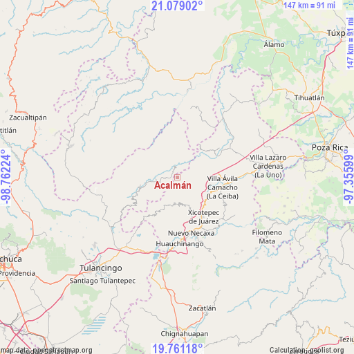
Acalmán GPS coordinates[2]
20° 25' 17.436" North, 98° 3' 32.796" West
| Map corner | latitude | longitude |
|---|---|---|
| Upper-left | 21.07902°, | -98.76224° |
| Center: | 20.42151°, | -98.05911° |
| Lower-right: | 19.76118°, | -97.35599° |
| Map W x H: | 146.5×146.5 km | = 91×91mi |
| max Lat: | 32.7° ⇑33.9% North |
| Acalmán: | 20.42151° |
| min Lat: | ⇓66.1% South 14.53588° |
| min Long | Acalmán | max Long |
| -117.105° | -98.05911° | -86.73105° |
| W 62.9%⇐ | ⇒37.1% E |
Elevation
Elevation of Acalmán is 778 m = 2552 ft, and this is 475.7 m = 1561 ft below average elevation for this country.
| Max E: |
3497 m = 11473 ft | 63.6% |
| Avg. | 1253.7 m = 4113 ft | |
| Acalmán | 778 m = 2552 ft | |
Min E: |
-1 m = -3 ft | 36.4% |
See also: Mexico elevation on elevation.city.
Geographical zone
Acalmán is located in North Torrid zone (between Equator and Tropic of Cancer). Distance of this Northern Tropic circle is 335.3 km =208.3 mi to North.| Distance of | km | miles | from Acalmán |
|---|---|---|---|
| North Pole | 7736.4 | 4807.2 | to North |
| Arctic Circle | 5130.5 | 3187.9 | to North |
| Tropic Cancer | 335.3 | 208.3 | to North |
| Equator | 2270.7 | 1410.9 | to South |


Nearby cities:
15 places around Acalmán: (largest is in red/bold)
• Acuautla
8.1 km =5 mi,  19°
19°
• Barrio Aztlán
5.6 km =3.5 mi,  330°
330°
• Cuautepec
9.3 km =5.8 mi,  169°
169°
• Cuaxtla
5.6 km =3.5 mi,  194°
194°
• El Jericó
9.7 km =6 mi,  142°
142°
• El Ocotal
4.4 km =2.7 mi,  234°
234°
• El Rincón
5.7 km =3.5 mi,  74°
74°
• El Álamo
5.6 km =3.5 mi,  160°
160°
• Huehuetla
4.7 km =2.9 mi,  337°
337°
• San Antonio el Grande
4.7 km =2.9 mi,  32°
32°
• San Clemente
9.3 km =5.8 mi,  258°
258°
• San Gregorio
9.5 km =5.9 mi, 26°
• Santa Inés
5 km =3.1 mi,  319°
319°
• Santa Úrsula
4.8 km =3 mi,  268°
268°
• Tlaxco
3.1 km =1.9 mi,  86°
86°
Sources, notices
• [Note1] Compared only with cities in Mexico existing in our database
• [Src1] Map data: © OpenStreetMap contributors (CC-BY-SA)
• [Src2] Other city data from geonames.org with taken over terms of usage.
• [Src3] Geographical zone / Annual Mean Temperature by Robert A. Rohde @ Wikipedia
