Álvaro Obregón geodata
Álvaro Obregón (Chiapas) is a populated place; located in Mexico in America/Mexico_City (GMT-6) time zone. With population of 867 people, there are 10083 cities with bigger population in this country. Compared to other cities in Mexico, 88.5% of cities are located further ↑North; 89.8% of cities are located further ←West and 50.9% of cities have higher elevation than Álvaro Obregón. Note1


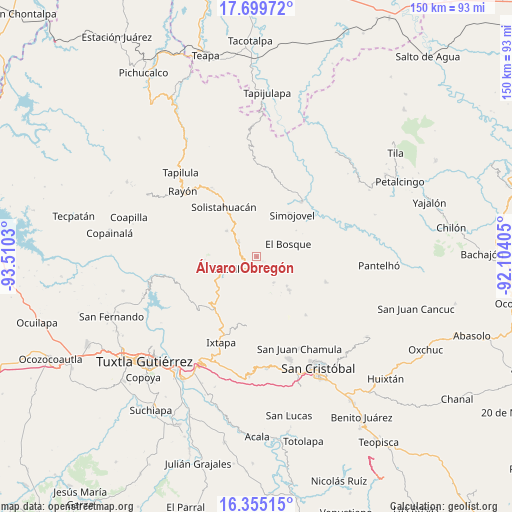
Álvaro Obregón GPS coordinates[2]
17° 1' 43.104" North, 92° 48' 25.812" West
| Map corner | latitude | longitude |
|---|---|---|
| Upper-left | 17.69972°, | -93.5103° |
| Center: | 17.02864°, | -92.80717° |
| Lower-right: | 16.35515°, | -92.10405° |
| Map W x H: | 149.5×149.5 km | = 92.9×92.9mi |
| max Lat: | 32.7° ⇑88.5% North |
| Álvaro Obregón: | 17.02864° |
| min Lat: | ⇓11.5% South 14.53588° |
| min Long | Álvaro Obregó | max Long |
| -117.105° | -92.80717° | -86.73105° |
| W 89.8%⇐ | ⇒10.2% E |
Elevation
Elevation of Álvaro Obregón is 1387 m = 4551 ft, and this is 133.3 m = 437 ft above average elevation for this country.
| Max E: |
3497 m = 11473 ft | 50.9% |
| Álvaro Obregón | 1387 m 4551 ft | |
| Avg. | 1253.7 m = 4113 ft | |
Min E: |
-1 m = -3 ft | 49.1% |
See also: Mexico elevation on elevation.city.
Geographical zone
Álvaro Obregón is located in North Torrid zone (between Equator and Tropic of Cancer). Distance of this Northern Tropic circle is 712.5 km =442.7 mi to North.| Distance of | km | miles | from Álvaro Obregón |
|---|---|---|---|
| North Pole | 8113.7 | 5041.6 | to North |
| Arctic Circle | 5507.8 | 3422.4 | to North |
| Tropic Cancer | 712.5 | 442.7 | to North |
| Equator | 1893.4 | 1176.5 | to South |


Nearby cities:
15 places around Álvaro Obregón: (largest is in red/bold)
• Altagracia
3.5 km =2.2 mi,  82°
82°
• Altamirano
9.4 km =5.8 mi,  5°
5°
• Bochil
9.7 km =6 mi,  248°
248°
• Carmen Zacatal
5.8 km =3.6 mi,  4°
4°
• Chuchiltón
8.2 km =5.1 mi,  197°
197°
• Chuchiltón Anexo Potobtic Dos
7.6 km =4.7 mi,  215°
215°
• Cálido
8.1 km =5 mi, 14°
• El Ámbar
2.9 km =1.8 mi,  261°
261°
• Jitotol
7.2 km =4.5 mi,  306°
306°
• Los Plátanos
7.3 km =4.5 mi,  110°
110°
• Los Ángeles
6.2 km =3.9 mi,  74°
74°
• Majoval
4.2 km =2.6 mi,  206°
206°
• San Cayetano
9 km =5.6 mi,  146°
146°
• San Pedro Nichtalucum
8.6 km =5.3 mi,  85°
85°
• Unión Zaragoza
7.2 km =4.5 mi,  324°
324°
Sources, notices
• [Note1] Compared only with cities in Mexico existing in our database
• [Src1] Map data: © OpenStreetMap contributors (CC-BY-SA)
• [Src2] Other city data from geonames.org with taken over terms of usage.
• [Src3] Geographical zone / Annual Mean Temperature by Robert A. Rohde @ Wikipedia
