San Pablo Tejalpa geodata
San Pablo Tejalpa (State of Mexico) is a populated place; located in Mexico in America/Mexico_City (GMT-6) time zone. With population of 1,782 people, there are 4877 cities with bigger population in this country. Compared to other cities in Mexico, 67.7% of cities are located further ↑North; 58.4% of cities are located further →East and 59% of cities have lower elevation than San Pablo Tejalpa. Note1


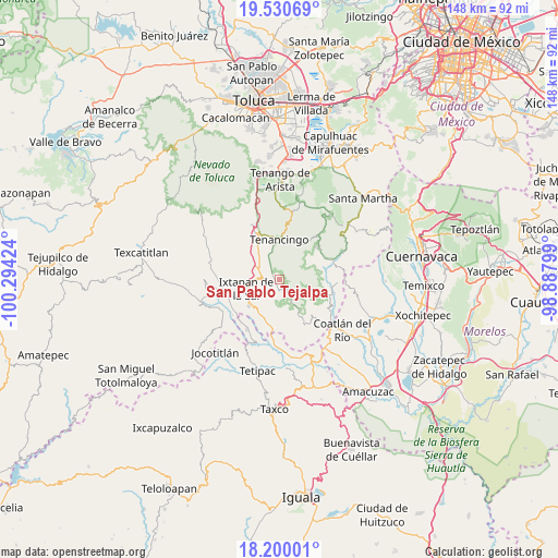
San Pablo Tejalpa GPS coordinates[2]
18° 52' 0.012" North, 99° 35' 27.996" West
| Map corner | latitude | longitude |
|---|---|---|
| Upper-left | 19.53069°, | -100.29424° |
| Center: | 18.86667°, | -99.59111° |
| Lower-right: | 18.20001°, | -98.88799° |
| Map W x H: | 148×148 km | = 92×92mi |
| max Lat: | 32.7° ⇑67.7% North |
| San Pablo Tejalpa: | 18.86667° |
| min Lat: | ⇓32.3% South 14.53588° |
| min Long | San Pablo Tejal | max Long |
| -117.105° | -99.59111° | -86.73105° |
| W 41.6%⇐ | ⇒58.4% E |
Elevation
Elevation of San Pablo Tejalpa is 1709 m = 5607 ft, and this is 455.3 m = 1494 ft above average elevation for this country.
| Max E: |
3497 m = 11473 ft | 41% |
| San Pablo Tejalpa | 1709 m 5607 ft | |
| Avg. | 1253.7 m = 4113 ft | |
Min E: |
-1 m = -3 ft | 59% |
See also: Mexico elevation on elevation.city.
Geographical zone
San Pablo Tejalpa is located in North Torrid zone (between Equator and Tropic of Cancer). Distance of this Northern Tropic circle is 508.1 km =315.7 mi to North.| Distance of | km | miles | from San Pablo Tejalpa |
|---|---|---|---|
| North Pole | 7909.3 | 4914.6 | to North |
| Arctic Circle | 5303.4 | 3295.4 | to North |
| Tropic Cancer | 508.1 | 315.7 | to North |
| Equator | 2097.8 | 1303.5 | to South |


Nearby cities:
15 places around San Pablo Tejalpa: (largest is in red/bold)
• Acatzingo (Acatzingo de la Piedra)
6.4 km =4 mi,  2°
2°
• Ejido de la Finca
4.4 km =2.7 mi,  300°
300°
• El Carmen (El Desierto del Carmen)
7 km =4.3 mi,  31°
31°
• El Progreso Hidalgo
3.3 km =2.1 mi,  227°
227°
• Guadalupe Tlapizalco
2.5 km =1.6 mi, 304°
• La Ascensión
3.5 km =2.2 mi,  151°
151°
• La Finca
5.8 km =3.6 mi, 297°
• Potrero Nuevo
5.4 km =3.4 mi,  312°
312°
• San Antonio Guadalupe
4.4 km =2.7 mi,  341°
341°
• San José Chalmita
4.6 km =2.9 mi,  101°
101°
• San Juan
2.7 km =1.7 mi, 153°
• Santa Catarina
2 km =1.2 mi,  21°
21°
• Terrenate
6.8 km =4.2 mi,  357°
357°
• Zumpahuacán
3.4 km =2.1 mi,  161°
161°
• Zumpahuacán
6.1 km =3.8 mi, 25°
Sources, notices
• [Note1] Compared only with cities in Mexico existing in our database
• [Src1] Map data: © OpenStreetMap contributors (CC-BY-SA)
• [Src2] Other city data from geonames.org with taken over terms of usage.
• [Src3] Geographical zone / Annual Mean Temperature by Robert A. Rohde @ Wikipedia
