La Finca geodata
La Finca (State of Mexico) is a populated place; located in Mexico in America/Mexico_City (GMT-6) time zone. With population of 1,680 people, there are 5169 cities with bigger population in this country. Compared to other cities in Mexico, 67.2% of cities are located further ↑North; 59.2% of cities are located further →East and 67% of cities have lower elevation than La Finca. Note1


La Finca GPS coordinates[2]
18° 53' 25.692" North, 99° 38' 25.008" West
| Map corner | latitude | longitude |
|---|---|---|
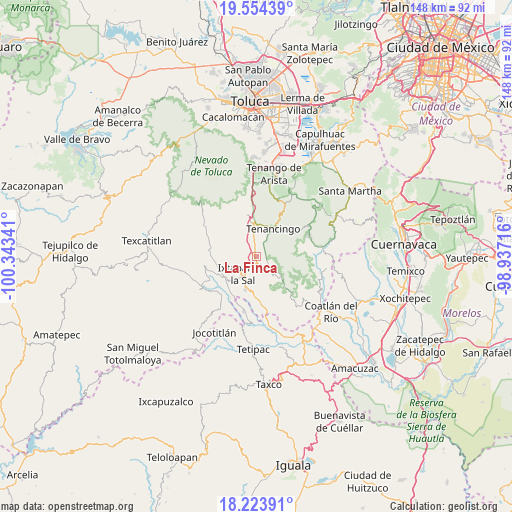
| Upper-left | 19.55439°, | -100.34341° |
| Center: | 18.89047°, | -99.64028° |
| Lower-right: | 18.22391°, | -98.93716° |
| Map W x H: | 147.9×147.9 km | = 91.9×91.9mi |
| max Lat: | 32.7° ⇑67.2% North |
| La Finca: | 18.89047° |
| min Lat: | ⇓32.8% South 14.53588° |
| min Long | La Finca | max Long |
| -117.105° | -99.64028° | -86.73105° |
| W 40.8%⇐ | ⇒59.2% E |
Elevation
Elevation of La Finca is 1870 m = 6135 ft, and this is 616.3 m = 2022 ft above average elevation for this country.
| Max E: |
3497 m = 11473 ft | 33% |
| La Finca | 1870 m 6135 ft | |
| Avg. | 1253.7 m = 4113 ft | |
Min E: |
-1 m = -3 ft | 67% |
See also: Mexico elevation on elevation.city.
Geographical zone
La Finca is located in North Torrid zone (between Equator and Tropic of Cancer). Distance of this Northern Tropic circle is 505.5 km =314.1 mi to North.| Distance of | km | miles | from La Finca |
|---|---|---|---|
| North Pole | 7906.6 | 4912.9 | to North |
| Arctic Circle | 5300.8 | 3293.8 | to North |
| Tropic Cancer | 505.5 | 314.1 | to North |
| Equator | 2100.4 | 1305.1 | to South |


Nearby cities:
15 places around La Finca: (largest is in red/bold)
• Buenavista
6.4 km =4 mi,  344°
344°
• Ejido de la Finca
1.5 km =0.9 mi,  108°
108°
• El Progreso Hidalgo
5.6 km =3.5 mi,  150°
150°
• Guadalupe Tlapizalco
3.3 km =2.1 mi, 111°
• Jesús Carranza (Rancho de Jesús)
6.2 km =3.9 mi,  9°
9°
• La Lagunilla
4.8 km =3 mi,  30°
30°
• Potrero Nuevo
1.5 km =0.9 mi,  51°
51°
• San Antonio Guadalupe
4.1 km =2.5 mi,  68°
68°
• San Felipe
5 km =3.1 mi, 342°
• San Miguel Laderas
6 km =3.7 mi,  262°
262°
• San Pablo Tejalpa
5.8 km =3.6 mi,  117°
117°
• Santa Catarina
6 km =3.7 mi,  97°
97°
• Tepetzingo
6 km =3.7 mi, 28°
• Terrenate
6.4 km =4 mi, 50°
• Totolmajac
6.3 km =3.9 mi,  310°
310°
Sources, notices
• [Note1] Compared only with cities in Mexico existing in our database
• [Src1] Map data: © OpenStreetMap contributors (CC-BY-SA)
• [Src2] Other city data from geonames.org with taken over terms of usage.
• [Src3] Geographical zone / Annual Mean Temperature by Robert A. Rohde @ Wikipedia
