Potrero Nuevo geodata
Potrero Nuevo (State of Mexico) is a populated place; located in Mexico in America/Mexico_City (GMT-6) time zone. With population of 685 people, there are 12680 cities with bigger population in this country. Compared to other cities in Mexico, 67.1% of cities are located further ↑North; 59.1% of cities are located further →East and 67% of cities have lower elevation than Potrero Nuevo. Note1


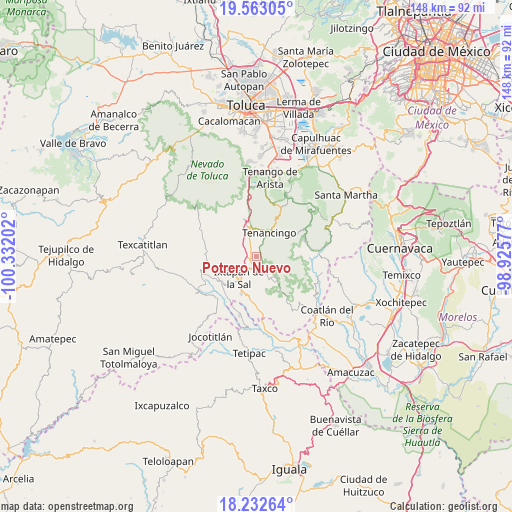
Potrero Nuevo GPS coordinates[2]
18° 53' 57.012" North, 99° 37' 44.004" West
| Map corner | latitude | longitude |
|---|---|---|
| Upper-left | 19.56305°, | -100.33202° |
| Center: | 18.89917°, | -99.62889° |
| Lower-right: | 18.23264°, | -98.92577° |
| Map W x H: | 147.9×147.9 km | = 91.9×91.9mi |
| max Lat: | 32.7° ⇑67.1% North |
| Potrero Nuevo: | 18.89917° |
| min Lat: | ⇓32.9% South 14.53588° |
| min Long | Potrero Nuevo | max Long |
| -117.105° | -99.62889° | -86.73105° |
| W 40.9%⇐ | ⇒59.1% E |
Elevation
Elevation of Potrero Nuevo is 1869 m = 6132 ft, and this is 615.3 m = 2019 ft above average elevation for this country.
| Max E: |
3497 m = 11473 ft | 33% |
| Potrero Nuevo | 1869 m 6132 ft | |
| Avg. | 1253.7 m = 4113 ft | |
Min E: |
-1 m = -3 ft | 67% |
See also: Mexico elevation on elevation.city.
Geographical zone
Potrero Nuevo is located in North Torrid zone (between Equator and Tropic of Cancer). Distance of this Northern Tropic circle is 504.5 km =313.5 mi to North.| Distance of | km | miles | from Potrero Nuevo |
|---|---|---|---|
| North Pole | 7905.7 | 4912.4 | to North |
| Arctic Circle | 5299.8 | 3293.1 | to North |
| Tropic Cancer | 504.5 | 313.5 | to North |
| Equator | 2101.4 | 1305.7 | to South |


Nearby cities:
15 places around Potrero Nuevo: (largest is in red/bold)
• Acatzingo (Acatzingo de la Piedra)
5.1 km =3.2 mi,  57°
57°
• Ejido de San Mateo Coapexco
5.7 km =3.5 mi,  345°
345°
• Ejido de la Finca
1.4 km =0.9 mi,  171°
171°
• Guadalupe Tlapizalco
2.9 km =1.8 mi,  139°
139°
• Jesús Carranza (Rancho de Jesús)
5.1 km =3.2 mi,  358°
358°
• La Finca
1.5 km =0.9 mi,  231°
231°
• La Lagunilla
3.4 km =2.1 mi,  21°
21°
• Quetzalapa
5.7 km =3.5 mi,  36°
36°
• San Antonio Guadalupe
2.6 km =1.6 mi,  78°
78°
• San Felipe
4.6 km =2.9 mi,  324°
324°
• San Pablo Tejalpa
5.4 km =3.4 mi,  132°
132°
• Santa Catarina
5 km =3.1 mi,  110°
110°
• Tepalcatepec
5.1 km =3.2 mi, 37°
• Tepetzingo
4.7 km =2.9 mi, 21°
• Terrenate
4.9 km =3 mi,  49°
49°
Sources, notices
• [Note1] Compared only with cities in Mexico existing in our database
• [Src1] Map data: © OpenStreetMap contributors (CC-BY-SA)
• [Src2] Other city data from geonames.org with taken over terms of usage.
• [Src3] Geographical zone / Annual Mean Temperature by Robert A. Rohde @ Wikipedia
