Moctezuma geodata
Moctezuma (Puebla) is a populated place; located in Mexico in America/Mexico_City (GMT-6) time zone. With population of 557 people, there are 15314 cities with bigger population in this country. Compared to other cities in Mexico, 71.7% of cities are located further ↓South; 65.9% of cities are located further ←West and 73.8% of cities have higher elevation than Moctezuma. Note1


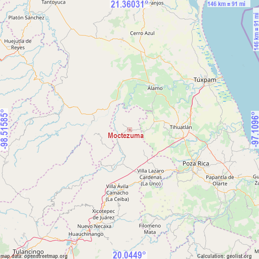
Moctezuma GPS coordinates[2]
20° 42' 14.508" North, 97° 48' 45.792" West
| Map corner | latitude | longitude |
|---|---|---|
| Upper-left | 21.36031°, | -98.51585° |
| Center: | 20.70403°, | -97.81272° |
| Lower-right: | 20.0449°, | -97.1096° |
| Map W x H: | 146.3×146.3 km | = 90.9×90.9mi |
| max Lat: | 32.7° ⇑28.3% North |
| Moctezuma: | 20.70403° |
| min Lat: | ⇓71.7% South 14.53588° |
| min Long | Moctezuma | max Long |
| -117.105° | -97.81272° | -86.73105° |
| W 65.9%⇐ | ⇒34.1% E |
Elevation
Elevation of Moctezuma is 261 m = 856 ft, and this is 992.7 m = 3257 ft below average elevation for this country.
| Max E: |
3497 m = 11473 ft | 73.8% |
| Avg. | 1253.7 m = 4113 ft | |
| Moctezuma | 261 m = 856 ft | |
Min E: |
-1 m = -3 ft | 26.2% |
See also: Mexico elevation on elevation.city.
Geographical zone
Moctezuma is located in North Torrid zone (between Equator and Tropic of Cancer). Distance of this Northern Tropic circle is 303.8 km =188.8 mi to North.| Distance of | km | miles | from Moctezuma |
|---|---|---|---|
| North Pole | 7705 | 4787.7 | to North |
| Arctic Circle | 5099.1 | 3168.4 | to North |
| Tropic Cancer | 303.8 | 188.8 | to North |
| Equator | 2302.1 | 1430.5 | to South |


Nearby cities:
15 places around Moctezuma: (largest is in red/bold)
• Agua Linda
14.2 km =8.8 mi,  202°
202°
• Ameluca
15.7 km =9.8 mi,  184°
184°
• El Tecomate
8.6 km =5.3 mi,  29°
29°
• Huitzilac
13.1 km =8.1 mi,  145°
145°
• Jaltocan
9.4 km =5.8 mi, 183°
• La Defensa
10.6 km =6.6 mi,  112°
112°
• La Pahua
11.1 km =6.9 mi, 202°
• Las Balsas
2.9 km =1.8 mi,  91°
91°
• Metlaltoyuca
5.4 km =3.4 mi,  310°
310°
• Ojital Cuayo
15.3 km =9.5 mi,  272°
272°
• Palma Real de Adentro
13.5 km =8.4 mi,  39°
39°
• Paso del Perro
15.9 km =9.9 mi,  7°
7°
• Progreso de Allende
12.7 km =7.9 mi,  222°
222°
• San Martín
13.1 km =8.1 mi, 265°
• Teayo
14.5 km =9 mi,  72°
72°
Sources, notices
• [Note1] Compared only with cities in Mexico existing in our database
• [Src1] Map data: © OpenStreetMap contributors (CC-BY-SA)
• [Src2] Other city data from geonames.org with taken over terms of usage.
• [Src3] Geographical zone / Annual Mean Temperature by Robert A. Rohde @ Wikipedia
