Guadalupe Sarabia geodata
Guadalupe Sarabia (Puebla) is a populated place; located in Mexico in America/Mexico_City (GMT-6) time zone. With population of 1,519 people, there are 5675 cities with bigger population in this country. Compared to other cities in Mexico, 53.5% of cities are located further ↑North; 70.3% of cities are located further ←West and 90.9% of cities have lower elevation than Guadalupe Sarabia. Note1


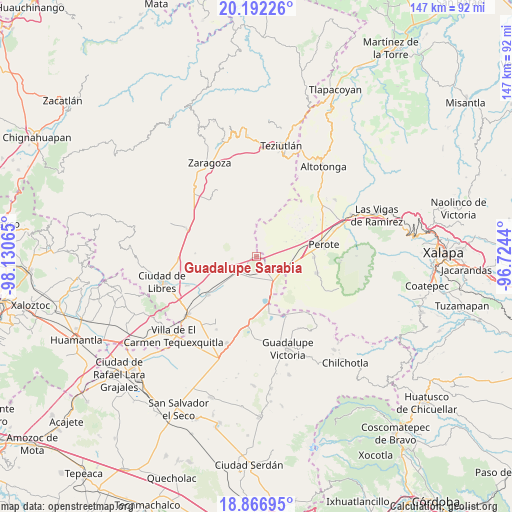
Guadalupe Sarabia GPS coordinates[2]
19° 31' 51.456" North, 97° 25' 39.072" West
| Map corner | latitude | longitude |
|---|---|---|
| Upper-left | 20.19226°, | -98.13065° |
| Center: | 19.53096°, | -97.42752° |
| Lower-right: | 18.86695°, | -96.7244° |
| Map W x H: | 147.4×147.4 km | = 91.6×91.6mi |
| max Lat: | 32.7° ⇑53.5% North |
| Guadalupe Sarabia: | 19.53096° |
| min Lat: | ⇓46.5% South 14.53588° |
| min Long | Guadalupe Sarab | max Long |
| -117.105° | -97.42752° | -86.73105° |
| W 70.3%⇐ | ⇒29.7% E |
Elevation
Elevation of Guadalupe Sarabia is 2437 m = 7995 ft, and this is 1183.3 m = 3882 ft above average elevation for this country.
| Max E: |
3497 m = 11473 ft | 9.1% |
| Guadalupe Sarabia | 2437 m 7995 ft | |
| Avg. | 1253.7 m = 4113 ft | |
Min E: |
-1 m = -3 ft | 90.9% |
See also: Mexico elevation on elevation.city.
Geographical zone
Guadalupe Sarabia is located in North Torrid zone (between Equator and Tropic of Cancer). Distance of this Northern Tropic circle is 434.3 km =269.9 mi to North.| Distance of | km | miles | from Guadalupe Sarabia |
|---|---|---|---|
| North Pole | 7835.4 | 4868.7 | to North |
| Arctic Circle | 5229.5 | 3249.5 | to North |
| Tropic Cancer | 434.3 | 269.9 | to North |
| Equator | 2171.6 | 1349.4 | to South |


Nearby cities:
15 places around Guadalupe Sarabia: (largest is in red/bold)
• Allende
17.8 km =11.1 mi,  272°
272°
• Chichicuautla
16 km =9.9 mi,  167°
167°
• Francisco I. Madero
11.4 km =7.1 mi,  321°
321°
• Francisco I. Madero
16.4 km =10.2 mi,  91°
91°
• Frijol Colorado
10.2 km =6.3 mi,  50°
50°
• Guadalupe Victoria
15.7 km =9.8 mi, 85°
• Guadalupe Victoria
16.7 km =10.4 mi, 317°
• Itzoteno
12.8 km =8 mi,  184°
184°
• San José Alchichica
11.4 km =7.1 mi,  159°
159°
• Techachalco
16.7 km =10.4 mi, 183°
• Tepeyehualco de Hidalgo
8.3 km =5.2 mi,  235°
235°
• Tetipanapa
13.4 km =8.3 mi, 237°
• Texcal
12.8 km =8 mi,  300°
300°
• Xaltipanapa
8.4 km =5.2 mi, 298°
• Zalayeta (Alchichica y el Bordo)
13.8 km =8.6 mi, 164°
Sources, notices
• [Note1] Compared only with cities in Mexico existing in our database
• [Src1] Map data: © OpenStreetMap contributors (CC-BY-SA)
• [Src2] Other city data from geonames.org with taken over terms of usage.
• [Src3] Geographical zone / Annual Mean Temperature by Robert A. Rohde @ Wikipedia
