Itzoteno geodata
Itzoteno (Puebla) is a populated place; located in Mexico in America/Mexico_City (GMT-6) time zone. With population of 1,347 people, there are 6461 cities with bigger population in this country. Compared to other cities in Mexico, 55.9% of cities are located further ↑North; 70.2% of cities are located further ←West and 87.8% of cities have lower elevation than Itzoteno. Note1


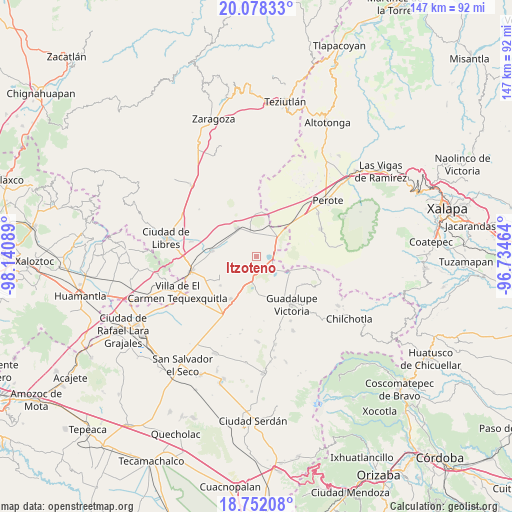
Itzoteno GPS coordinates[2]
19° 24' 59.616" North, 97° 26' 15.936" West
| Map corner | latitude | longitude |
|---|---|---|
| Upper-left | 20.07833°, | -98.14089° |
| Center: | 19.41656°, | -97.43776° |
| Lower-right: | 18.75208°, | -96.73464° |
| Map W x H: | 147.5×147.5 km | = 91.7×91.7mi |
| max Lat: | 32.7° ⇑55.9% North |
| Itzoteno: | 19.41656° |
| min Lat: | ⇓44.1% South 14.53588° |
| min Long | Itzoteno | max Long |
| -117.105° | -97.43776° | -86.73105° |
| W 70.2%⇐ | ⇒29.8% E |
Elevation
Elevation of Itzoteno is 2334 m = 7657 ft, and this is 1080.3 m = 3544 ft above average elevation for this country.
| Max E: |
3497 m = 11473 ft | 12.2% |
| Itzoteno | 2334 m 7657 ft | |
| Avg. | 1253.7 m = 4113 ft | |
Min E: |
-1 m = -3 ft | 87.8% |
See also: Mexico elevation on elevation.city.
Geographical zone
Itzoteno is located in North Torrid zone (between Equator and Tropic of Cancer). Distance of this Northern Tropic circle is 447 km =277.8 mi to North.| Distance of | km | miles | from Itzoteno |
|---|---|---|---|
| North Pole | 7848.1 | 4876.6 | to North |
| Arctic Circle | 5242.3 | 3257.4 | to North |
| Tropic Cancer | 447 | 277.8 | to North |
| Equator | 2158.9 | 1341.5 | to South |


Nearby cities:
15 places around Itzoteno: (largest is in red/bold)
• Chichicuautla
5.4 km =3.4 mi,  122°
122°
• El Fuerte de la Unión
13 km =8.1 mi,  276°
276°
• El Progreso
15.9 km =9.9 mi,  102°
102°
• Emilio Portes Gil
14.3 km =8.9 mi,  212°
212°
• Guadalupe Sarabia
12.8 km =8 mi,  4°
4°
• Hacienda Nueva (San Pedro el Águila)
9.5 km =5.9 mi,  163°
163°
• Maravillas
15.5 km =9.6 mi, 121°
• Miravalles
13.5 km =8.4 mi,  231°
231°
• Quechulac
10.6 km =6.6 mi, 117°
• San José Alchichica
5.4 km =3.4 mi,  68°
68°
• Techachalco
4 km =2.5 mi,  177°
177°
• Tepeyehualco de Hidalgo
9.9 km =6.2 mi,  324°
324°
• Tetipanapa
11.7 km =7.3 mi,  298°
298°
• Xaltepec
9.5 km =5.9 mi,  114°
114°
• Zalayeta (Alchichica y el Bordo)
4.8 km =3 mi, 96°
Sources, notices
• [Note1] Compared only with cities in Mexico existing in our database
• [Src1] Map data: © OpenStreetMap contributors (CC-BY-SA)
• [Src2] Other city data from geonames.org with taken over terms of usage.
• [Src3] Geographical zone / Annual Mean Temperature by Robert A. Rohde @ Wikipedia
