Tepeyehualco de Hidalgo geodata
Tepeyehualco de Hidalgo (Puebla) is a populated place; located in Mexico in America/Mexico_City (GMT-6) time zone. With population of 1,406 people, there are 6155 cities with bigger population in this country. Compared to other cities in Mexico, 54.3% of cities are located further ↑North; 69.6% of cities are located further ←West and 87.5% of cities have lower elevation than Tepeyehualco de Hidalgo. Note1
Current local time in Tepeyehualco de Hidalgo:
09:01 AM, MondayDifference from your time zone: hours


Tepeyehualco de Hidalgo GPS coordinates[2]
19° 29' 19.212" North, 97° 29' 33.144" West
| Map corner | latitude | longitude |
|---|---|---|
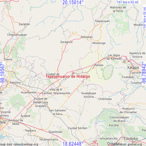
| Upper-left | 20.15014°, | -98.19567° |
| Center: | 19.48867°, | -97.49254° |
| Lower-right: | 18.82448°, | -96.78942° |
| Map W x H: | 147.4×147.4 km | = 91.6×91.6mi |
| max Lat: | 32.7° ⇑54.3% North |
| Tepeyehualco de Hidalgo: | 19.48867° |
| min Lat: | ⇓45.7% South 14.53588° |
| min Long | Tepeyehualco de | max Long |
| -117.105° | -97.49254° | -86.73105° |
| W 69.6%⇐ | ⇒30.4% E |
Elevation
Elevation of Tepeyehualco de Hidalgo is 2327 m = 7635 ft, and this is 1073.3 m = 3521 ft above average elevation for this country.
| Max E: |
3497 m = 11473 ft | 12.5% |
| Tepeyehualco de Hidalgo | 2327 m 7635 ft | |
| Avg. | 1253.7 m = 4113 ft | |
Min E: |
-1 m = -3 ft | 87.5% |
See also: Mexico elevation on elevation.city.
Geographical zone
Tepeyehualco de Hidalgo is located in North Torrid zone (between Equator and Tropic of Cancer). Distance of this Northern Tropic circle is 439 km =272.8 mi to North.| Distance of | km | miles | from Tepeyehualco de Hidalgo |
|---|---|---|---|
| North Pole | 7840.1 | 4871.6 | to North |
| Arctic Circle | 5234.2 | 3252.4 | to North |
| Tropic Cancer | 439 | 272.8 | to North |
| Equator | 2166.9 | 1346.4 | to South |


Nearby cities:
15 places around Tepeyehualco de Hidalgo: (largest is in red/bold)
• Allende
12.3 km =7.6 mi,  296°
296°
• Chichicuautla
15 km =9.3 mi,  136°
136°
• El Fuerte de la Unión
9.6 km =6 mi,  227°
227°
• Francisco I. Madero
13.6 km =8.5 mi,  358°
358°
• Guadalupe Sarabia
8.3 km =5.2 mi,  55°
55°
• Itzoteno
9.9 km =6.2 mi, 144°
• Miravalles
17.1 km =10.6 mi,  196°
196°
• Nuevo México
13.6 km =8.5 mi,  254°
254°
• San Andrés Payuca
13.8 km =8.6 mi,  287°
287°
• San José Alchichica
12.3 km =7.6 mi,  119°
119°
• Techachalco
13.4 km =8.3 mi,  153°
153°
• Tetipanapa
5.1 km =3.2 mi,  241°
241°
• Texcal
12 km =7.5 mi,  339°
339°
• Xaltipanapa
8.8 km =5.5 mi, 356°
• Zalayeta (Alchichica y el Bordo)
13.6 km =8.5 mi,  129°
129°
Sources, notices
• [Note1] Compared only with cities in Mexico existing in our database
• [Src1] Map data: © OpenStreetMap contributors (CC-BY-SA)
• [Src2] Other city data from geonames.org with taken over terms of usage.
• [Src3] Geographical zone / Annual Mean Temperature by Robert A. Rohde @ Wikipedia
