Techachalco geodata
Techachalco (Puebla) is a populated place; located in Mexico in America/Mexico_City (GMT-6) time zone. With population of 927 people, there are 9410 cities with bigger population in this country. Compared to other cities in Mexico, 56.7% of cities are located further ↑North; 70.2% of cities are located further ←West and 88% of cities have lower elevation than Techachalco. Note1


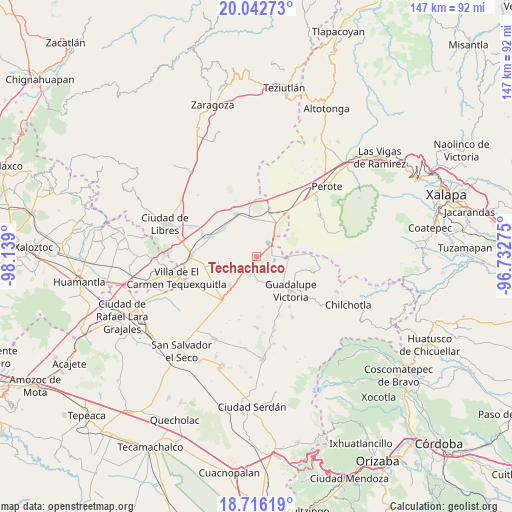
Techachalco GPS coordinates[2]
19° 22' 50.916" North, 97° 26' 9.132" West
| Map corner | latitude | longitude |
|---|---|---|
| Upper-left | 20.04273°, | -98.139° |
| Center: | 19.38081°, | -97.43587° |
| Lower-right: | 18.71619°, | -96.73275° |
| Map W x H: | 147.5×147.5 km | = 91.7×91.7mi |
| max Lat: | 32.7° ⇑56.7% North |
| Techachalco: | 19.38081° |
| min Lat: | ⇓43.3% South 14.53588° |
| min Long | Techachalco | max Long |
| -117.105° | -97.43587° | -86.73105° |
| W 70.2%⇐ | ⇒29.8% E |
Elevation
Elevation of Techachalco is 2342 m = 7684 ft, and this is 1088.3 m = 3571 ft above average elevation for this country.
| Max E: |
3497 m = 11473 ft | 12% |
| Techachalco | 2342 m 7684 ft | |
| Avg. | 1253.7 m = 4113 ft | |
Min E: |
-1 m = -3 ft | 88% |
See also: Mexico elevation on elevation.city.
Geographical zone
Techachalco is located in North Torrid zone (between Equator and Tropic of Cancer). Distance of this Northern Tropic circle is 451 km =280.2 mi to North.| Distance of | km | miles | from Techachalco |
|---|---|---|---|
| North Pole | 7852.1 | 4879.1 | to North |
| Arctic Circle | 5246.2 | 3259.8 | to North |
| Tropic Cancer | 451 | 280.2 | to North |
| Equator | 2154.9 | 1339 | to South |


Nearby cities:
15 places around Techachalco: (largest is in red/bold)
• Chichicuautla
4.5 km =2.8 mi,  75°
75°
• El Fuerte de la Unión
14.2 km =8.8 mi,  293°
293°
• El Progreso
15.4 km =9.6 mi,  88°
88°
• Emilio Portes Gil
11.3 km =7 mi,  223°
223°
• Guadalupe Victoria
14 km =8.7 mi,  135°
135°
• Hacienda Nueva (San Pedro el Águila)
5.7 km =3.5 mi,  154°
154°
• Itzoteno
4 km =2.5 mi,  357°
357°
• Maravillas
13.6 km =8.5 mi,  107°
107°
• Miravalles
11.6 km =7.2 mi,  247°
247°
• Quechulac
9.3 km =5.8 mi,  95°
95°
• San José Alchichica
7.7 km =4.8 mi,  38°
38°
• Tepeyehualco de Hidalgo
13.4 km =8.3 mi,  333°
333°
• Tetipanapa
14.2 km =8.8 mi,  312°
312°
• Xaltepec
8.4 km =5.2 mi, 89°
• Zalayeta (Alchichica y el Bordo)
5.7 km =3.5 mi,  53°
53°
Sources, notices
• [Note1] Compared only with cities in Mexico existing in our database
• [Src1] Map data: © OpenStreetMap contributors (CC-BY-SA)
• [Src2] Other city data from geonames.org with taken over terms of usage.
• [Src3] Geographical zone / Annual Mean Temperature by Robert A. Rohde @ Wikipedia
