Chichicaxtla geodata
Chichicaxtla (Puebla) is a populated place; located in Mexico in America/Mexico_City (GMT-6) time zone. With population of 675 people, there are 12870 cities with bigger population in this country. Compared to other cities in Mexico, 51.4% of cities are located further ↓South; 64% of cities are located further ←West and 96.1% of cities have lower elevation than Chichicaxtla. Note1


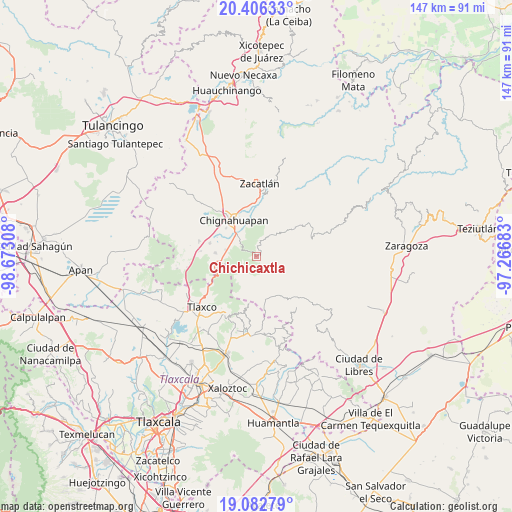
Chichicaxtla GPS coordinates[2]
19° 44' 45.348" North, 97° 58' 11.82" West
| Map corner | latitude | longitude |
|---|---|---|
| Upper-left | 20.40633°, | -98.67308° |
| Center: | 19.74593°, | -97.96995° |
| Lower-right: | 19.08279°, | -97.26683° |
| Map W x H: | 147.2×147.2 km | = 91.5×91.5mi |
| max Lat: | 32.7° ⇑48.6% North |
| Chichicaxtla: | 19.74593° |
| min Lat: | ⇓51.4% South 14.53588° |
| min Long | Chichicaxtla | max Long |
| -117.105° | -97.96995° | -86.73105° |
| W 64%⇐ | ⇒36% E |
Elevation
Elevation of Chichicaxtla is 2632 m = 8635 ft, and this is 1378.3 m = 4522 ft above average elevation for this country.
| Max E: |
3497 m = 11473 ft | 3.9% |
| Chichicaxtla | 2632 m 8635 ft | |
| Avg. | 1253.7 m = 4113 ft | |
Min E: |
-1 m = -3 ft | 96.1% |
See also: Mexico elevation on elevation.city.
Geographical zone
Chichicaxtla is located in North Torrid zone (between Equator and Tropic of Cancer). Distance of this Northern Tropic circle is 410.4 km =255 mi to North.| Distance of | km | miles | from Chichicaxtla |
|---|---|---|---|
| North Pole | 7811.5 | 4853.8 | to North |
| Arctic Circle | 5205.6 | 3234.6 | to North |
| Tropic Cancer | 410.4 | 255 | to North |
| Equator | 2195.5 | 1364.2 | to South |


Nearby cities:
15 places around Chichicaxtla: (largest is in red/bold)
• Aquixtla
6.6 km =4.1 mi,  32°
32°
• Atexcac
8.9 km =5.5 mi, 32°
• Calpanería Atezquilla
10.4 km =6.5 mi,  194°
194°
• Coacoyunga
9.8 km =6.1 mi,  320°
320°
• Cuautieco
6.4 km =4 mi,  50°
50°
• El Fresno
11.4 km =7.1 mi,  261°
261°
• El Terrero
5.1 km =3.2 mi, 26°
• Ixtlahuaca Barrio
11.3 km =7 mi,  335°
335°
• Loma Alta
8.3 km =5.2 mi,  313°
313°
• Lázaro Cárdenas (Tzitla)
11.7 km =7.3 mi, 311°
• Matlahuacales Aquiles Serdán
8.9 km =5.5 mi,  281°
281°
• San Antonio Matlahuacales
11.8 km =7.3 mi, 275°
• Sebastopol
6.5 km =4 mi,  304°
304°
• Tenextla
10.6 km =6.6 mi, 335°
• Tonalapa
12 km =7.5 mi, 51°
Sources, notices
• [Note1] Compared only with cities in Mexico existing in our database
• [Src1] Map data: © OpenStreetMap contributors (CC-BY-SA)
• [Src2] Other city data from geonames.org with taken over terms of usage.
• [Src3] Geographical zone / Annual Mean Temperature by Robert A. Rohde @ Wikipedia
