Calpanería Atezquilla geodata
Calpanería Atezquilla (Puebla) is a populated place; located in Mexico in America/Mexico_City (GMT-6) time zone. With population of 1,032 people, there are 8443 cities with bigger population in this country. Compared to other cities in Mexico, 50.7% of cities are located further ↑North; 63.7% of cities are located further ←West and 98.9% of cities have lower elevation than Calpanería Atezquilla. Note1
Current local time in Calpanería Atezquilla:
12:56 AM, WednesdayDifference from your time zone: hours


Calpanería Atezquilla GPS coordinates[2]
19° 39' 20.016" North, 97° 59' 43.008" West
| Map corner | latitude | longitude |
|---|---|---|
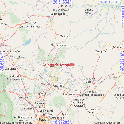
| Upper-left | 20.31634°, | -98.69841° |
| Center: | 19.65556°, | -97.99528° |
| Lower-right: | 18.99205°, | -97.29216° |
| Map W x H: | 147.2×147.2 km | = 91.5×91.5mi |
| max Lat: | 32.7° ⇑50.7% North |
| Calpanería Atezquilla: | 19.65556° |
| min Lat: | ⇓49.3% South 14.53588° |
| min Long | Calpanería Ate | max Long |
| -117.105° | -97.99528° | -86.73105° |
| W 63.7%⇐ | ⇒36.3% E |
Elevation
Elevation of Calpanería Atezquilla is 2825 m = 9268 ft, and this is 1571.3 m = 5155 ft above average elevation for this country.
| Max E: |
3497 m = 11473 ft | 1.1% |
| Calpanería Atezquilla | 2825 m 9268 ft | |
| Avg. | 1253.7 m = 4113 ft | |
Min E: |
-1 m = -3 ft | 98.9% |
See also: Mexico elevation on elevation.city.
Geographical zone
Calpanería Atezquilla is located in North Torrid zone (between Equator and Tropic of Cancer). Distance of this Northern Tropic circle is 420.4 km =261.2 mi to North.| Distance of | km | miles | from Calpanería Atezquilla |
|---|---|---|---|
| North Pole | 7821.6 | 4860.1 | to North |
| Arctic Circle | 5215.7 | 3240.9 | to North |
| Tropic Cancer | 420.4 | 261.2 | to North |
| Equator | 2185.5 | 1358 | to South |


Nearby cities:
15 places around Calpanería Atezquilla: (largest is in red/bold)
• Aquixtla
16.8 km =10.4 mi,  21°
21°
• Capula
14.1 km =8.8 mi,  200°
200°
• Chichicaxtla
10.4 km =6.5 mi,  14°
14°
• Cruz de León
15.5 km =9.6 mi,  122°
122°
• Cuautieco
16 km =9.9 mi,  28°
28°
• El Fresno
12 km =7.5 mi,  313°
313°
• El Terrero
15.4 km =9.6 mi, 18°
• Emiliano Zapata
13.6 km =8.5 mi,  142°
142°
• Loma Alta
16.1 km =10 mi,  348°
348°
• Lázaro Cárdenas
13.2 km =8.2 mi,  174°
174°
• Matlahuacales Aquiles Serdán
13.3 km =8.3 mi,  332°
332°
• San Antonio Matlahuacales
14.3 km =8.9 mi,  320°
320°
• Sebastopol
14 km =8.7 mi, 348°
• Tecomaluca
9.2 km =5.7 mi,  230°
230°
• Tlaxco
13.8 km =8.6 mi,  250°
250°
Sources, notices
• [Note1] Compared only with cities in Mexico existing in our database
• [Src1] Map data: © OpenStreetMap contributors (CC-BY-SA)
• [Src2] Other city data from geonames.org with taken over terms of usage.
• [Src3] Geographical zone / Annual Mean Temperature by Robert A. Rohde @ Wikipedia
