El Progreso geodata
El Progreso (Puebla) is a populated place; located in Mexico in America/Mexico_City (GMT-6) time zone. With population of 751 people, there are 11671 cities with bigger population in this country. Compared to other cities in Mexico, 56.6% of cities are located further ↑North; 71.6% of cities are located further ←West and 91.2% of cities have lower elevation than El Progreso. Note1


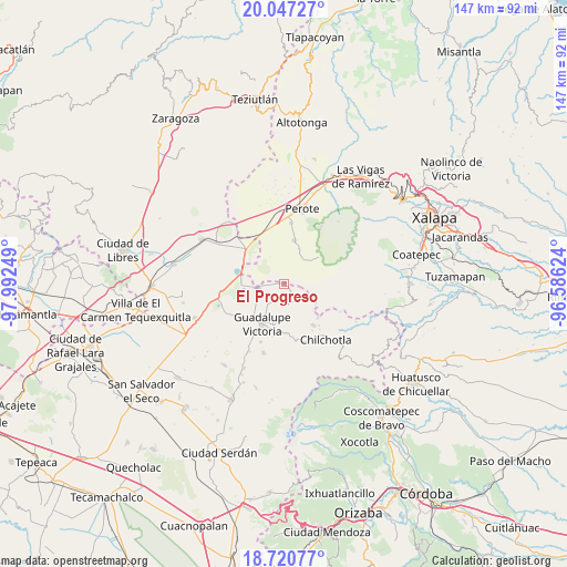
El Progreso GPS coordinates[2]
19° 23' 7.332" North, 97° 17' 21.696" West
| Map corner | latitude | longitude |
|---|---|---|
| Upper-left | 20.04727°, | -97.99249° |
| Center: | 19.38537°, | -97.28936° |
| Lower-right: | 18.72077°, | -96.58624° |
| Map W x H: | 147.5×147.5 km | = 91.7×91.7mi |
| max Lat: | 32.7° ⇑56.6% North |
| El Progreso: | 19.38537° |
| min Lat: | ⇓43.4% South 14.53588° |
| min Long | El Progreso | max Long |
| -117.105° | -97.28936° | -86.73105° |
| W 71.6%⇐ | ⇒28.4% E |
Elevation
Elevation of El Progreso is 2448 m = 8031 ft, and this is 1194.3 m = 3918 ft above average elevation for this country.
| Max E: |
3497 m = 11473 ft | 8.8% |
| El Progreso | 2448 m 8031 ft | |
| Avg. | 1253.7 m = 4113 ft | |
Min E: |
-1 m = -3 ft | 91.2% |
See also: Mexico elevation on elevation.city.
Geographical zone
El Progreso is located in North Torrid zone (between Equator and Tropic of Cancer). Distance of this Northern Tropic circle is 450.5 km =279.9 mi to North.| Distance of | km | miles | from El Progreso |
|---|---|---|---|
| North Pole | 7851.6 | 4878.8 | to North |
| Arctic Circle | 5245.7 | 3259.5 | to North |
| Tropic Cancer | 450.5 | 279.9 | to North |
| Equator | 2155.5 | 1339.4 | to South |


Nearby cities:
15 places around El Progreso: (largest is in red/bold)
• Altamirada
8.1 km =5 mi,  102°
102°
• Apantéopan
10.7 km =6.6 mi,  106°
106°
• Chichicuautla
11 km =6.8 mi,  273°
273°
• El Ciprés
8.8 km =5.5 mi, 100°
• El Triunfo
8.3 km =5.2 mi,  61°
61°
• González Ortega
5.2 km =3.2 mi,  157°
157°
• Guadalupe Victoria
11.9 km =7.4 mi,  208°
208°
• La Gloria
1.3 km =0.8 mi,  32°
32°
• Los Altos
11.4 km =7.1 mi,  53°
53°
• Maravillas
5.3 km =3.3 mi, 207°
• Quechulac
6.3 km =3.9 mi,  257°
257°
• Saltillo
9.9 km =6.2 mi,  184°
184°
• Tlalconteno
8.4 km =5.2 mi, 32°
• Xaltepec
7 km =4.3 mi, 265°
• Zalayeta (Alchichica y el Bordo)
11.1 km =6.9 mi,  285°
285°
Sources, notices
• [Note1] Compared only with cities in Mexico existing in our database
• [Src1] Map data: © OpenStreetMap contributors (CC-BY-SA)
• [Src2] Other city data from geonames.org with taken over terms of usage.
• [Src3] Geographical zone / Annual Mean Temperature by Robert A. Rohde @ Wikipedia
