La Gloria geodata
La Gloria (Puebla) is a populated place; located in Mexico in America/Mexico_City (GMT-6) time zone. With population of 2,510 people, there are 3523 cities with bigger population in this country. Compared to other cities in Mexico, 56.4% of cities are located further ↑North; 71.7% of cities are located further ←West and 91.5% of cities have lower elevation than La Gloria. Note1


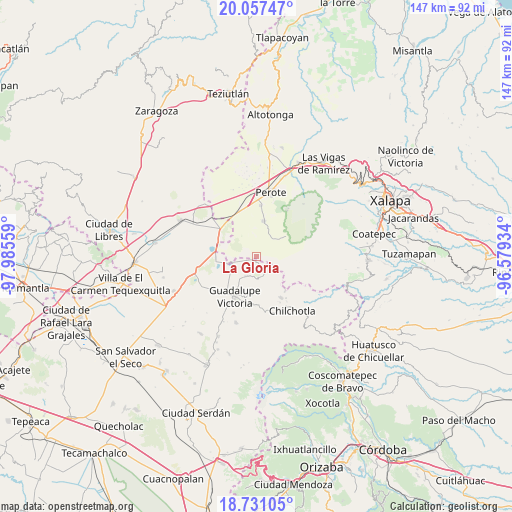
La Gloria GPS coordinates[2]
19° 23' 44.196" North, 97° 16' 56.856" West
| Map corner | latitude | longitude |
|---|---|---|
| Upper-left | 20.05747°, | -97.98559° |
| Center: | 19.39561°, | -97.28246° |
| Lower-right: | 18.73105°, | -96.57934° |
| Map W x H: | 147.5×147.5 km | = 91.7×91.7mi |
| max Lat: | 32.7° ⇑56.4% North |
| La Gloria: | 19.39561° |
| min Lat: | ⇓43.6% South 14.53588° |
| min Long | La Gloria | max Long |
| -117.105° | -97.28246° | -86.73105° |
| W 71.7%⇐ | ⇒28.3% E |
Elevation
Elevation of La Gloria is 2459 m = 8068 ft, and this is 1205.3 m = 3954 ft above average elevation for this country.
| Max E: |
3497 m = 11473 ft | 8.5% |
| La Gloria | 2459 m 8068 ft | |
| Avg. | 1253.7 m = 4113 ft | |
Min E: |
-1 m = -3 ft | 91.5% |
See also: Mexico elevation on elevation.city.
Geographical zone
La Gloria is located in North Torrid zone (between Equator and Tropic of Cancer). Distance of this Northern Tropic circle is 449.3 km =279.2 mi to North.| Distance of | km | miles | from La Gloria |
|---|---|---|---|
| North Pole | 7850.5 | 4878.1 | to North |
| Arctic Circle | 5244.6 | 3258.8 | to North |
| Tropic Cancer | 449.3 | 279.2 | to North |
| Equator | 2156.6 | 1340 | to South |


Nearby cities:
15 places around La Gloria: (largest is in red/bold)
• Altamirada
7.7 km =4.8 mi,  112°
112°
• Apantéopan
10.5 km =6.5 mi, 113°
• Chichicuautla
11.7 km =7.3 mi,  267°
267°
• El Ciprés
8.4 km =5.2 mi, 109°
• El Progreso
1.3 km =0.8 mi,  212°
212°
• El Triunfo
7.1 km =4.4 mi,  66°
66°
• González Ortega
6 km =3.7 mi,  167°
167°
• La Toma
11.3 km =7 mi,  55°
55°
• Los Altos
10.1 km =6.3 mi, 56°
• Maravillas
6.6 km =4.1 mi, 208°
• Quechulac
7.3 km =4.5 mi,  249°
249°
• Saltillo
11.1 km =6.9 mi,  187°
187°
• Tlalconteno
7 km =4.3 mi,  32°
32°
• Xaltepec
7.9 km =4.9 mi,  258°
258°
• Zalayeta (Alchichica y el Bordo)
11.6 km =7.2 mi,  278°
278°
Sources, notices
• [Note1] Compared only with cities in Mexico existing in our database
• [Src1] Map data: © OpenStreetMap contributors (CC-BY-SA)
• [Src2] Other city data from geonames.org with taken over terms of usage.
• [Src3] Geographical zone / Annual Mean Temperature by Robert A. Rohde @ Wikipedia
