Tlanicuilulco geodata
Tlanicuilulco (Guerrero) is a populated place; located in Mexico in America/Mexico_City (GMT-6) time zone. With population of 944 people, there are 9225 cities with bigger population in this country. Compared to other cities in Mexico, 84.3% of cities are located further ↑North; 51.2% of cities are located further →East and 65.6% of cities have higher elevation than Tlanicuilulco. Note1


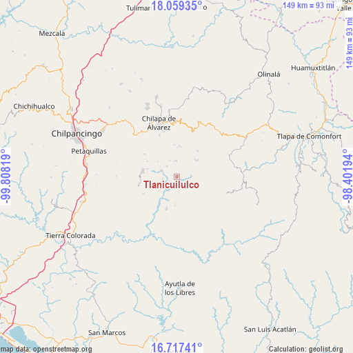
Tlanicuilulco GPS coordinates[2]
17° 23' 22.596" North, 99° 6' 18.216" West
| Map corner | latitude | longitude |
|---|---|---|
| Upper-left | 18.05935°, | -99.80819° |
| Center: | 17.38961°, | -99.10506° |
| Lower-right: | 16.71741°, | -98.40194° |
| Map W x H: | 149.2×149.2 km | = 92.7×92.7mi |
| max Lat: | 32.7° ⇑84.3% North |
| Tlanicuilulco: | 17.38961° |
| min Lat: | ⇓15.7% South 14.53588° |
| min Long | Tlanicuilulco | max Long |
| -117.105° | -99.10506° | -86.73105° |
| W 48.8%⇐ | ⇒51.2% E |
Elevation
Elevation of Tlanicuilulco is 655 m = 2149 ft, and this is 598.7 m = 1964 ft below average elevation for this country.
| Max E: |
3497 m = 11473 ft | 65.6% |
| Avg. | 1253.7 m = 4113 ft | |
| Tlanicuilulco | 655 m = 2149 ft | |
Min E: |
-1 m = -3 ft | 34.4% |
See also: Mexico elevation on elevation.city.
Geographical zone
Tlanicuilulco is located in North Torrid zone (between Equator and Tropic of Cancer). Distance of this Northern Tropic circle is 672.4 km =417.8 mi to North.| Distance of | km | miles | from Tlanicuilulco |
|---|---|---|---|
| North Pole | 8073.5 | 5016.6 | to North |
| Arctic Circle | 5467.6 | 3397.4 | to North |
| Tropic Cancer | 672.4 | 417.8 | to North |
| Equator | 1933.5 | 1201.4 | to South |


Nearby cities:
15 places around Tlanicuilulco: (largest is in red/bold)
• Ayahualtempa
10.5 km =6.5 mi,  43°
43°
• Colotlipa
7.1 km =4.4 mi,  291°
291°
• El Epazote
5.9 km =3.7 mi,  114°
114°
• Hueycantenango
10.8 km =6.7 mi,  52°
52°
• Jocutla
6.3 km =3.9 mi,  213°
213°
• Juxtlahuaca
6.2 km =3.9 mi,  315°
315°
• Llano Grande
0.8 km =0.5 mi, 46°
• Mexcalcingo
11.2 km =7 mi,  92°
92°
• Nanzintla
6.1 km =3.8 mi,  173°
173°
• Popocatzin
9 km =5.6 mi,  98°
98°
• Santa Fe
10.1 km =6.3 mi,  284°
284°
• Tlalchichiltipán Nuevo
11.2 km =7 mi, 85°
• Tlalixtlahuacán
10.8 km =6.7 mi,  351°
351°
• Xiloxuchicán
10.9 km =6.8 mi,  328°
328°
• Zelocotitlán
6.3 km =3.9 mi,  358°
358°
Sources, notices
• [Note1] Compared only with cities in Mexico existing in our database
• [Src1] Map data: © OpenStreetMap contributors (CC-BY-SA)
• [Src2] Other city data from geonames.org with taken over terms of usage.
• [Src3] Geographical zone / Annual Mean Temperature by Robert A. Rohde @ Wikipedia
