San Marcos geodata
San Marcos (Guerrero) is a populated place; located in Mexico in America/Mexico_City (GMT-6) time zone. With population of 1,078 people, there are 8085 cities with bigger population in this country. Compared to other cities in Mexico, 84.8% of cities are located further ↑North; 50.1% of cities are located further ←West and 50.7% of cities have higher elevation than San Marcos. Note1


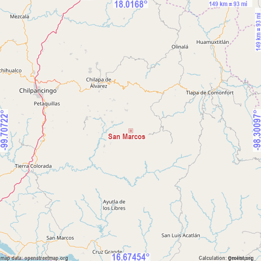
San Marcos GPS coordinates[2]
17° 20' 48.84" North, 99° 0' 14.724" West
| Map corner | latitude | longitude |
|---|---|---|
| Upper-left | 18.0168°, | -99.70722° |
| Center: | 17.3469°, | -99.00409° |
| Lower-right: | 16.67454°, | -98.30097° |
| Map W x H: | 149.2×149.2 km | = 92.7×92.7mi |
| max Lat: | 32.7° ⇑84.8% North |
| San Marcos: | 17.3469° |
| min Lat: | ⇓15.2% South 14.53588° |
| min Long | San Marcos | max Long |
| -117.105° | -99.00409° | -86.73105° |
| W 50.1%⇐ | ⇒49.9% E |
Elevation
Elevation of San Marcos is 1394 m = 4573 ft, and this is 140.3 m = 460 ft above average elevation for this country.
| Max E: |
3497 m = 11473 ft | 50.7% |
| San Marcos | 1394 m 4573 ft | |
| Avg. | 1253.7 m = 4113 ft | |
Min E: |
-1 m = -3 ft | 49.3% |
See also: Mexico elevation on elevation.city.
Geographical zone
San Marcos is located in North Torrid zone (between Equator and Tropic of Cancer). Distance of this Northern Tropic circle is 677.1 km =420.7 mi to North.| Distance of | km | miles | from San Marcos |
|---|---|---|---|
| North Pole | 8078.3 | 5019.6 | to North |
| Arctic Circle | 5472.4 | 3400.4 | to North |
| Tropic Cancer | 677.1 | 420.7 | to North |
| Equator | 1928.8 | 1198.5 | to South |


Nearby cities:
15 places around San Marcos: (largest is in red/bold)
• Acatepec
10.3 km =6.4 mi,  103°
103°
• Apanguito
11.4 km =7.1 mi,  10°
10°
• Cacahuatepec
6.7 km =4.2 mi,  34°
34°
• Caxitepec
7 km =4.3 mi,  146°
146°
• Chichiltepec
7.3 km =4.5 mi, 98°
• El Epazote
5.8 km =3.6 mi,  293°
293°
• Huixolotepec (Huitzolotepec)
10.5 km =6.5 mi,  76°
76°
• Ixcatla
8.4 km =5.2 mi,  3°
3°
• Llano Grande
11.4 km =7.1 mi,  297°
297°
• Mexcalcingo
4.3 km =2.7 mi, 6°
• Nanzintla
10.1 km =6.3 mi,  262°
262°
• Popocatzin
3.8 km =2.4 mi,  331°
331°
• Tlalchichiltipán Nuevo
5.7 km =3.5 mi, 4°
• Tonalapa
6.7 km =4.2 mi,  123°
123°
• Zoquitlán
5.9 km =3.7 mi, 95°
Sources, notices
• [Note1] Compared only with cities in Mexico existing in our database
• [Src1] Map data: © OpenStreetMap contributors (CC-BY-SA)
• [Src2] Other city data from geonames.org with taken over terms of usage.
• [Src3] Geographical zone / Annual Mean Temperature by Robert A. Rohde @ Wikipedia
