Miahuichán geodata
Miahuichán (Guerrero) is a populated place; located in Mexico in America/Mexico_City (GMT-6) time zone. With population of 761 people, there are 11509 cities with bigger population in this country. Compared to other cities in Mexico, 91.7% of cities are located further ↑North; 53.4% of cities are located further ←West and 71.6% of cities have higher elevation than Miahuichán. Note1


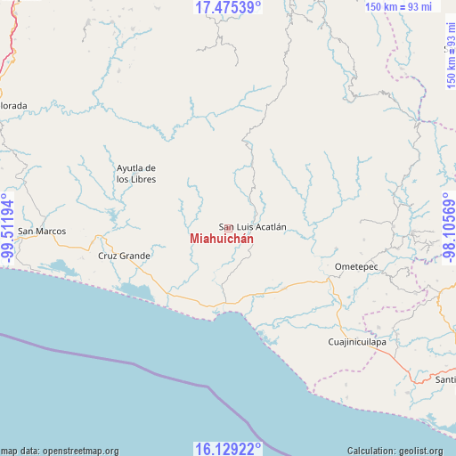
Miahuichán GPS coordinates[2]
16° 48' 12.6" North, 98° 48' 31.716" West
| Map corner | latitude | longitude |
|---|---|---|
| Upper-left | 17.47539°, | -99.51194° |
| Center: | 16.8035°, | -98.80881° |
| Lower-right: | 16.12922°, | -98.10569° |
| Map W x H: | 149.7×149.7 km | = 93×93mi |
| max Lat: | 32.7° ⇑91.7% North |
| Miahuichán: | 16.8035° |
| min Lat: | ⇓8.3% South 14.53588° |
| min Long | Miahuichán | max Long |
| -117.105° | -98.80881° | -86.73105° |
| W 53.4%⇐ | ⇒46.6% E |
Elevation
Elevation of Miahuichán is 342 m = 1122 ft, and this is 911.7 m = 2991 ft below average elevation for this country.
| Max E: |
3497 m = 11473 ft | 71.6% |
| Avg. | 1253.7 m = 4113 ft | |
| Miahuichán | 342 m = 1122 ft | |
Min E: |
-1 m = -3 ft | 28.4% |
See also: Mexico elevation on elevation.city.
Geographical zone
Miahuichán is located in North Torrid zone (between Equator and Tropic of Cancer). Distance of this Northern Tropic circle is 737.5 km =458.3 mi to North.| Distance of | km | miles | from Miahuichán |
|---|---|---|---|
| North Pole | 8138.7 | 5057.2 | to North |
| Arctic Circle | 5532.8 | 3437.9 | to North |
| Tropic Cancer | 737.5 | 458.3 | to North |
| Equator | 1868.4 | 1161 | to South |


Nearby cities:
15 places around Miahuichán: (largest is in red/bold)
• Arcelia de Rodríguez
19 km =11.8 mi,  113°
113°
• Camalotillo (El Camalotillo)
17.3 km =10.7 mi,  58°
58°
• Coacoyulichán
13.5 km =8.4 mi,  265°
265°
• Cuanacaxtitlán
18 km =11.2 mi,  91°
91°
• El Capulín Chocolate
16.2 km =10.1 mi,  161°
161°
• El Carmen
5.5 km =3.4 mi,  78°
78°
• El Coquillo
15.6 km =9.7 mi,  236°
236°
• Horcasitas
11.5 km =7.1 mi,  35°
35°
• Huamuchititán (El Huamuchito)
16.9 km =10.5 mi,  247°
247°
• Jolotichán
10.1 km =6.3 mi,  124°
124°
• Mesón Zapote
18 km =11.2 mi,  290°
290°
• Poza Verde
10.5 km =6.5 mi, 270°
• San Luis Acatlán
8.1 km =5 mi, 85°
• Yoloxóchitl
13.1 km =8.1 mi, 83°
• Zoyatlán
13.2 km =8.2 mi,  142°
142°
Sources, notices
• [Note1] Compared only with cities in Mexico existing in our database
• [Src1] Map data: © OpenStreetMap contributors (CC-BY-SA)
• [Src2] Other city data from geonames.org with taken over terms of usage.
• [Src3] Geographical zone / Annual Mean Temperature by Robert A. Rohde @ Wikipedia
