Jolotichán geodata
Jolotichán (Guerrero) is a populated place; located in Mexico in America/Mexico_City (GMT-6) time zone. With population of 1,550 people, there are 5564 cities with bigger population in this country. Compared to other cities in Mexico, 92.3% of cities are located further ↑North; 54.6% of cities are located further ←West and 73.2% of cities have higher elevation than Jolotichán. Note1


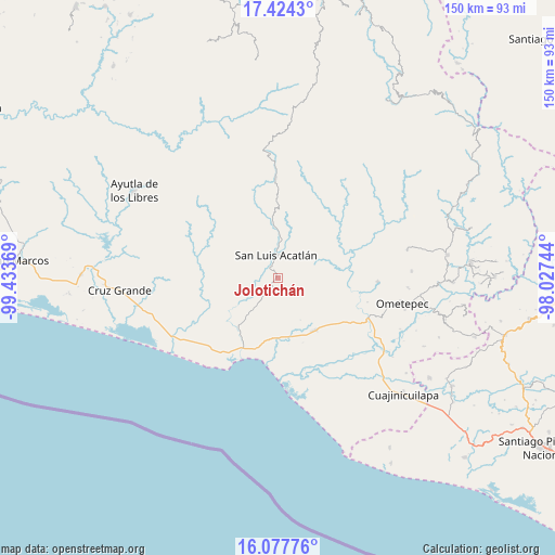
Jolotichán GPS coordinates[2]
16° 45' 7.992" North, 98° 43' 50.016" West
| Map corner | latitude | longitude |
|---|---|---|
| Upper-left | 17.4243°, | -99.43369° |
| Center: | 16.75222°, | -98.73056° |
| Lower-right: | 16.07776°, | -98.02744° |
| Map W x H: | 149.7×149.7 km | = 93×93mi |
| max Lat: | 32.7° ⇑92.3% North |
| Jolotichán: | 16.75222° |
| min Lat: | ⇓7.7% South 14.53588° |
| min Long | Jolotichán | max Long |
| -117.105° | -98.73056° | -86.73105° |
| W 54.6%⇐ | ⇒45.4% E |
Elevation
Elevation of Jolotichán is 281 m = 922 ft, and this is 972.7 m = 3191 ft below average elevation for this country.
| Max E: |
3497 m = 11473 ft | 73.2% |
| Avg. | 1253.7 m = 4113 ft | |
| Jolotichán | 281 m = 922 ft | |
Min E: |
-1 m = -3 ft | 26.8% |
See also: Mexico elevation on elevation.city.
Geographical zone
Jolotichán is located in North Torrid zone (between Equator and Tropic of Cancer). Distance of this Northern Tropic circle is 743.2 km =461.8 mi to North.| Distance of | km | miles | from Jolotichán |
|---|---|---|---|
| North Pole | 8144.4 | 5060.7 | to North |
| Arctic Circle | 5538.5 | 3441.5 | to North |
| Tropic Cancer | 743.2 | 461.8 | to North |
| Equator | 1862.7 | 1157.4 | to South |


Nearby cities:
15 places around Jolotichán: (largest is in red/bold)
• Agua Zarca
14.6 km =9.1 mi,  168°
168°
• Arcelia de Rodríguez
9.3 km =5.8 mi,  100°
100°
• Azoyú
13.9 km =8.6 mi, 98°
• Camalotillo (El Camalotillo)
16.1 km =10 mi,  23°
23°
• Cuanacaxtitlán
11 km =6.8 mi,  61°
61°
• El Capulín Chocolate
10.1 km =6.3 mi,  197°
197°
• El Carmen
7.4 km =4.6 mi,  336°
336°
• Horcasitas
15.2 km =9.4 mi,  353°
353°
• Maxmadi
15.2 km =9.4 mi,  83°
83°
• Miahuichán
10.1 km =6.3 mi,  304°
304°
• San Isidro el Puente (El Puente)
15.4 km =9.6 mi,  134°
134°
• San Luis Acatlán
6.3 km =3.9 mi,  357°
357°
• Yoloxóchitl
8.5 km =5.3 mi,  33°
33°
• Zapotitlán de la Fuente (El Zapote)
11.8 km =7.3 mi, 102°
• Zoyatlán
4.8 km =3 mi,  183°
183°
Sources, notices
• [Note1] Compared only with cities in Mexico existing in our database
• [Src1] Map data: © OpenStreetMap contributors (CC-BY-SA)
• [Src2] Other city data from geonames.org with taken over terms of usage.
• [Src3] Geographical zone / Annual Mean Temperature by Robert A. Rohde @ Wikipedia
