Las Haldas geodata
Las Haldas (Veracruz) is a populated place; located in Mexico in America/Mexico_City (GMT-6) time zone. With population of 951 people, there are 9161 cities with bigger population in this country. Compared to other cities in Mexico, 51.3% of cities are located further ↑North; 77% of cities are located further ←West and 59.3% of cities have higher elevation than Las Haldas. Note1


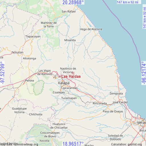
Las Haldas GPS coordinates[2]
19° 37' 43.644" North, 96° 49' 29.496" West
| Map corner | latitude | longitude |
|---|---|---|
| Upper-left | 20.28968°, | -97.52799° |
| Center: | 19.62879°, | -96.82486° |
| Lower-right: | 18.96517°, | -96.12174° |
| Map W x H: | 147.3×147.3 km | = 91.5×91.5mi |
| max Lat: | 32.7° ⇑51.3% North |
| Las Haldas: | 19.62879° |
| min Lat: | ⇓48.7% South 14.53588° |
| min Long | Las Haldas | max Long |
| -117.105° | -96.82486° | -86.73105° |
| W 77%⇐ | ⇒23% E |
Elevation
Elevation of Las Haldas is 1037 m = 3402 ft, and this is 216.7 m = 711 ft below average elevation for this country.
| Max E: |
3497 m = 11473 ft | 59.3% |
| Avg. | 1253.7 m = 4113 ft | |
| Las Haldas | 1037 m = 3402 ft | |
Min E: |
-1 m = -3 ft | 40.7% |
See also: Mexico elevation on elevation.city.
Geographical zone
Las Haldas is located in North Torrid zone (between Equator and Tropic of Cancer). Distance of this Northern Tropic circle is 423.4 km =263.1 mi to North.| Distance of | km | miles | from Las Haldas |
|---|---|---|---|
| North Pole | 7824.5 | 4861.9 | to North |
| Arctic Circle | 5218.7 | 3242.7 | to North |
| Tropic Cancer | 423.4 | 263.1 | to North |
| Equator | 2182.5 | 1356.1 | to South |


Nearby cities:
15 places around Las Haldas: (largest is in red/bold)
• Acatlán
7.8 km =4.8 mi,  346°
346°
• Almolonga
6.1 km =3.8 mi,  134°
134°
• Chiltoyac
7.2 km =4.5 mi,  217°
217°
• El Espinal
5 km =3.1 mi,  264°
264°
• La Concepción
8.3 km =5.2 mi,  252°
252°
• Las Lomas
9.1 km =5.7 mi,  265°
265°
• Mafafas
7.9 km =4.9 mi,  65°
65°
• Naolinco de Victoria
5.8 km =3.6 mi,  299°
299°
• San Antonio Paso del Toro
5.2 km =3.2 mi,  195°
195°
• San Marcos Atesquilapan
9.3 km =5.8 mi,  316°
316°
• Seis de Enero
6.8 km =4.2 mi,  186°
186°
• Tenampa
4.3 km =2.7 mi,  243°
243°
• Tepetlán
5.7 km =3.5 mi,  30°
30°
• Tronconal
8.2 km =5.1 mi,  209°
209°
• Vicente Guerrero (Tepetates)
2.7 km =1.7 mi,  137°
137°
Sources, notices
• [Note1] Compared only with cities in Mexico existing in our database
• [Src1] Map data: © OpenStreetMap contributors (CC-BY-SA)
• [Src2] Other city data from geonames.org with taken over terms of usage.
• [Src3] Geographical zone / Annual Mean Temperature by Robert A. Rohde @ Wikipedia
