Reyixtla geodata
Reyixtla (Veracruz) is a populated place; located in Mexico in America/Mexico_City (GMT-6) time zone. With population of 525 people, there are 16085 cities with bigger population in this country. Compared to other cities in Mexico, 74.4% of cities are located further ↓South; 62.9% of cities are located further ←West and 73.3% of cities have higher elevation than Reyixtla. Note1


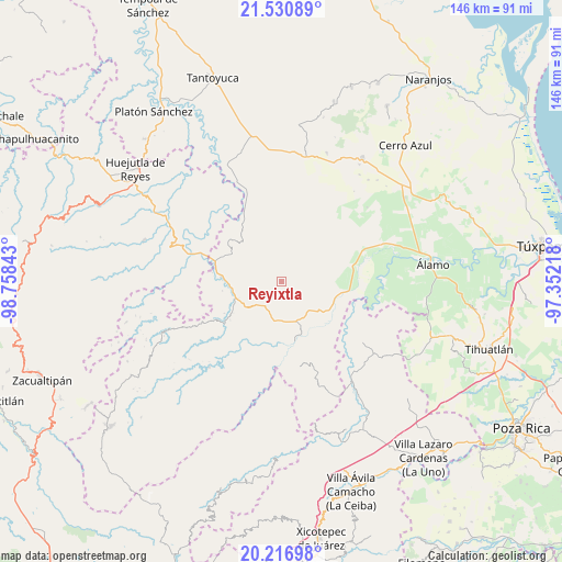
Reyixtla GPS coordinates[2]
20° 52' 31.332" North, 98° 3' 19.08" West
| Map corner | latitude | longitude |
|---|---|---|
| Upper-left | 21.53089°, | -98.75843° |
| Center: | 20.87537°, | -98.0553° |
| Lower-right: | 20.21698°, | -97.35218° |
| Map W x H: | 146.1×146.1 km | = 90.8×90.8mi |
| max Lat: | 32.7° ⇑25.6% North |
| Reyixtla: | 20.87537° |
| min Lat: | ⇓74.4% South 14.53588° |
| min Long | Reyixtla | max Long |
| -117.105° | -98.0553° | -86.73105° |
| W 62.9%⇐ | ⇒37.1% E |
Elevation
Elevation of Reyixtla is 279 m = 915 ft, and this is 974.7 m = 3198 ft below average elevation for this country.
| Max E: |
3497 m = 11473 ft | 73.3% |
| Avg. | 1253.7 m = 4113 ft | |
| Reyixtla | 279 m = 915 ft | |
Min E: |
-1 m = -3 ft | 26.7% |
See also: Mexico elevation on elevation.city.
Geographical zone
Reyixtla is located in North Torrid zone (between Equator and Tropic of Cancer). Distance of this Northern Tropic circle is 284.8 km =177 mi to North.| Distance of | km | miles | from Reyixtla |
|---|---|---|---|
| North Pole | 7685.9 | 4775.8 | to North |
| Arctic Circle | 5080.1 | 3156.6 | to North |
| Tropic Cancer | 284.8 | 177 | to North |
| Equator | 2321.1 | 1442.3 | to South |


Nearby cities:
15 places around Reyixtla: (largest is in red/bold)
• Ayacaxtle
12 km =7.5 mi,  31°
31°
• Ayolia
8.3 km =5.2 mi,  125°
125°
• Cacahuatengo
10.1 km =6.3 mi,  170°
170°
• Colatlán
7.9 km =4.9 mi,  213°
213°
• El Limón
4.3 km =2.7 mi, 172°
• Huexotitla
12.2 km =7.6 mi,  196°
196°
• Ixcacuatitla
4.9 km =3 mi,  42°
42°
• La Reforma
11.5 km =7.1 mi,  235°
235°
• Llano de Enmedio
11.1 km =6.9 mi,  157°
157°
• Lomas del Dorado
10.8 km =6.7 mi, 133°
• Palma Real
11.3 km =7 mi,  226°
226°
• Pemuxtitla
10.8 km =6.7 mi,  290°
290°
• Piedra Grande
10.6 km =6.6 mi, 173°
• Tecomate
10.9 km =6.8 mi,  12°
12°
• Xochimilco
2 km =1.2 mi, 227°
Sources, notices
• [Note1] Compared only with cities in Mexico existing in our database
• [Src1] Map data: © OpenStreetMap contributors (CC-BY-SA)
• [Src2] Other city data from geonames.org with taken over terms of usage.
• [Src3] Geographical zone / Annual Mean Temperature by Robert A. Rohde @ Wikipedia
