Ixcacuatitla geodata
Ixcacuatitla (Veracruz) is a populated place; located in Mexico in America/Mexico_City (GMT-6) time zone. With population of 716 people, there are 12166 cities with bigger population in this country. Compared to other cities in Mexico, 74.9% of cities are located further ↓South; 63.3% of cities are located further ←West and 68.9% of cities have higher elevation than Ixcacuatitla. Note1


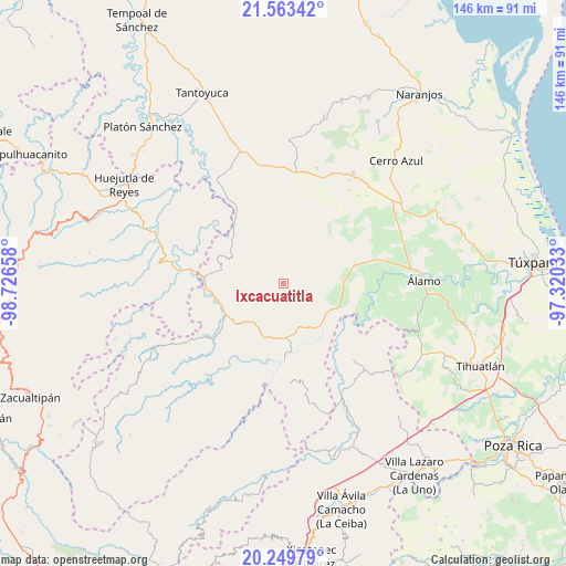
Ixcacuatitla GPS coordinates[2]
20° 54' 28.944" North, 98° 1' 24.42" West
| Map corner | latitude | longitude |
|---|---|---|
| Upper-left | 21.56342°, | -98.72658° |
| Center: | 20.90804°, | -98.02345° |
| Lower-right: | 20.24979°, | -97.32033° |
| Map W x H: | 146.1×146.1 km | = 90.8×90.8mi |
| max Lat: | 32.7° ⇑25.1% North |
| Ixcacuatitla: | 20.90804° |
| min Lat: | ⇓74.9% South 14.53588° |
| min Long | Ixcacuatitla | max Long |
| -117.105° | -98.02345° | -86.73105° |
| W 63.3%⇐ | ⇒36.7% E |
Elevation
Elevation of Ixcacuatitla is 472 m = 1549 ft, and this is 781.7 m = 2565 ft below average elevation for this country.
| Max E: |
3497 m = 11473 ft | 68.9% |
| Avg. | 1253.7 m = 4113 ft | |
| Ixcacuatitla | 472 m = 1549 ft | |
Min E: |
-1 m = -3 ft | 31.1% |
See also: Mexico elevation on elevation.city.
Geographical zone
Ixcacuatitla is located in North Torrid zone (between Equator and Tropic of Cancer). Distance of this Northern Tropic circle is 281.2 km =174.7 mi to North.| Distance of | km | miles | from Ixcacuatitla |
|---|---|---|---|
| North Pole | 7682.3 | 4773.6 | to North |
| Arctic Circle | 5076.4 | 3154.3 | to North |
| Tropic Cancer | 281.2 | 174.7 | to North |
| Equator | 2324.8 | 1444.6 | to South |


Nearby cities:
15 places around Ixcacuatitla: (largest is in red/bold)
• Ayacaxtle
7.2 km =4.5 mi,  24°
24°
• Ayolia
9.2 km =5.7 mi,  157°
157°
• Cacahuatengo
13.7 km =8.5 mi,  187°
187°
• Colatlán
12.7 km =7.9 mi,  216°
216°
• El Limón
8.3 km =5.2 mi,  199°
199°
• Huizache Achichipic
13.4 km =8.3 mi,  295°
295°
• La Pagua
8.2 km =5.1 mi, 24°
• Las Placetas
13.9 km =8.6 mi,  4°
4°
• Llano de Enmedio
13.9 km =8.6 mi,  175°
175°
• Lomas del Dorado
11.9 km =7.4 mi, 157°
• Pemuxtitla
13.5 km =8.4 mi,  270°
270°
• Reyixtla
4.9 km =3 mi, 222°
• Tecomate
7 km =4.3 mi,  351°
351°
• Tzocohuite
14 km =8.7 mi,  136°
136°
• Xochimilco
6.9 km =4.3 mi, 223°
Sources, notices
• [Note1] Compared only with cities in Mexico existing in our database
• [Src1] Map data: © OpenStreetMap contributors (CC-BY-SA)
• [Src2] Other city data from geonames.org with taken over terms of usage.
• [Src3] Geographical zone / Annual Mean Temperature by Robert A. Rohde @ Wikipedia
