Ayacaxtle geodata
Ayacaxtle (Veracruz) is a populated place; located in Mexico in America/Mexico_City (GMT-6) time zone. With population of 508 people, there are 16554 cities with bigger population in this country. Compared to other cities in Mexico, 76% of cities are located further ↓South; 63.7% of cities are located further ←West and 73.6% of cities have higher elevation than Ayacaxtle. Note1


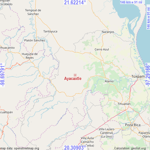
Ayacaxtle GPS coordinates[2]
20° 58' 1.308" North, 97° 59' 41.208" West
| Map corner | latitude | longitude |
|---|---|---|
| Upper-left | 21.62214°, | -98.69791° |
| Center: | 20.96703°, | -97.99478° |
| Lower-right: | 20.30903°, | -97.29166° |
| Map W x H: | 146×146 km | = 90.7×90.7mi |
| max Lat: | 32.7° ⇑24% North |
| Ayacaxtle: | 20.96703° |
| min Lat: | ⇓76% South 14.53588° |
| min Long | Ayacaxtle | max Long |
| -117.105° | -97.99478° | -86.73105° |
| W 63.7%⇐ | ⇒36.3% E |
Elevation
Elevation of Ayacaxtle is 267 m = 876 ft, and this is 986.7 m = 3237 ft below average elevation for this country.
| Max E: |
3497 m = 11473 ft | 73.6% |
| Avg. | 1253.7 m = 4113 ft | |
| Ayacaxtle | 267 m = 876 ft | |
Min E: |
-1 m = -3 ft | 26.4% |
See also: Mexico elevation on elevation.city.
Geographical zone
Ayacaxtle is located in North Torrid zone (between Equator and Tropic of Cancer). Distance of this Northern Tropic circle is 274.6 km =170.6 mi to North.| Distance of | km | miles | from Ayacaxtle |
|---|---|---|---|
| North Pole | 7675.7 | 4769.5 | to North |
| Arctic Circle | 5069.9 | 3150.3 | to North |
| Tropic Cancer | 274.6 | 170.6 | to North |
| Equator | 2331.3 | 1448.6 | to South |


Nearby cities:
15 places around Ayacaxtle: (largest is in red/bold)
• Ahuateno
16.6 km =10.3 mi,  283°
283°
• Ayolia
15.1 km =9.4 mi,  178°
178°
• El Limón
15.5 km =9.6 mi,  201°
201°
• El Mirador
7.3 km =4.5 mi,  46°
46°
• Huizache Achichipic
15 km =9.3 mi,  267°
267°
• Ixcacuatitla
7.2 km =4.5 mi, 204°
• La Pagua
1 km =0.6 mi,  27°
27°
• Las Placetas
7.6 km =4.7 mi,  344°
344°
• Las Puentes
9.1 km =5.7 mi,  356°
356°
• Lomas de Vinazco
16.4 km =10.2 mi,  134°
134°
• Reyixtla
12 km =7.5 mi,  211°
211°
• San Fernando
14.7 km =9.1 mi,  120°
120°
• Tecomate
4 km =2.5 mi, 276°
• Tlacolula
14.3 km =8.9 mi,  14°
14°
• Xochimilco
13.9 km =8.6 mi, 213°
Sources, notices
• [Note1] Compared only with cities in Mexico existing in our database
• [Src1] Map data: © OpenStreetMap contributors (CC-BY-SA)
• [Src2] Other city data from geonames.org with taken over terms of usage.
• [Src3] Geographical zone / Annual Mean Temperature by Robert A. Rohde @ Wikipedia
