Tzocohuite geodata
Tzocohuite (Veracruz) is a populated place; located in Mexico in America/Mexico_City (GMT-6) time zone. With population of 973 people, there are 8931 cities with bigger population in this country. Compared to other cities in Mexico, 73.5% of cities are located further ↓South; 64.4% of cities are located further ←West and 79.7% of cities have higher elevation than Tzocohuite. Note1


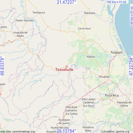
Tzocohuite GPS coordinates[2]
20° 48' 59.724" North, 97° 55' 50.376" West
| Map corner | latitude | longitude |
|---|---|---|
| Upper-left | 21.47237°, | -98.63379° |
| Center: | 20.81659°, | -97.93066° |
| Lower-right: | 20.15794°, | -97.22754° |
| Map W x H: | 146.2×146.2 km | = 90.8×90.8mi |
| max Lat: | 32.7° ⇑26.5% North |
| Tzocohuite: | 20.81659° |
| min Lat: | ⇓73.5% South 14.53588° |
| min Long | Tzocohuite | max Long |
| -117.105° | -97.93066° | -86.73105° |
| W 64.4%⇐ | ⇒35.6% E |
Elevation
Elevation of Tzocohuite is 100 m = 328 ft, and this is 1153.7 m = 3785 ft below average elevation for this country.
| Max E: |
3497 m = 11473 ft | 79.7% |
| Avg. | 1253.7 m = 4113 ft | |
| Tzocohuite | 100 m = 328 ft | |
Min E: |
-1 m = -3 ft | 20.3% |
See also: Mexico elevation on elevation.city.
Geographical zone
Tzocohuite is located in North Torrid zone (between Equator and Tropic of Cancer). Distance of this Northern Tropic circle is 291.3 km =181 mi to North.| Distance of | km | miles | from Tzocohuite |
|---|---|---|---|
| North Pole | 7692.5 | 4779.9 | to North |
| Arctic Circle | 5086.6 | 3160.7 | to North |
| Tropic Cancer | 291.3 | 181 | to North |
| Equator | 2314.6 | 1438.2 | to South |


Nearby cities:
15 places around Tzocohuite: (largest is in red/bold)
• Ayolia
6.4 km =4 mi,  284°
284°
• Cacahuatengo
11.9 km =7.4 mi,  253°
253°
• El Limón
12.6 km =7.8 mi, 280°
• Ixcacuatitla
14 km =8.7 mi,  316°
316°
• Joya Chica
13.8 km =8.6 mi,  211°
211°
• Llano de Enmedio
9.4 km =5.8 mi, 246°
• Lomas de Vinazco
7.3 km =4.5 mi,  43°
43°
• Lomas del Dorado
5.1 km =3.2 mi,  260°
260°
• Metlaltoyuca
12.2 km =7.6 mi,  137°
137°
• Ojital Cuayo
12.2 km =7.6 mi,  194°
194°
• Piedra Grande
12.4 km =7.7 mi, 250°
• Puyecaco
13.6 km =8.5 mi,  239°
239°
• Reyixtla
14.5 km =9 mi,  296°
296°
• San Fernando
10.9 km =6.8 mi,  33°
33°
• San Martín
13.6 km =8.5 mi,  183°
183°
Sources, notices
• [Note1] Compared only with cities in Mexico existing in our database
• [Src1] Map data: © OpenStreetMap contributors (CC-BY-SA)
• [Src2] Other city data from geonames.org with taken over terms of usage.
• [Src3] Geographical zone / Annual Mean Temperature by Robert A. Rohde @ Wikipedia
