Lomas de Vinazco geodata
Lomas de Vinazco (Veracruz) is a populated place; located in Mexico in America/Mexico_City (GMT-6) time zone. With population of 800 people, there are 10908 cities with bigger population in this country. Compared to other cities in Mexico, 74.2% of cities are located further ↓South; 65.1% of cities are located further ←West and 79.9% of cities have higher elevation than Lomas de Vinazco. Note1


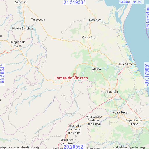
Lomas de Vinazco GPS coordinates[2]
20° 51' 50.256" North, 97° 52' 55.812" West
| Map corner | latitude | longitude |
|---|---|---|
| Upper-left | 21.51953°, | -98.5853° |
| Center: | 20.86396°, | -97.88217° |
| Lower-right: | 20.20552°, | -97.17905° |
| Map W x H: | 146.1×146.1 km | = 90.8×90.8mi |
| max Lat: | 32.7° ⇑25.8% North |
| Lomas de Vinazco: | 20.86396° |
| min Lat: | ⇓74.2% South 14.53588° |
| min Long | Lomas de Vinazc | max Long |
| -117.105° | -97.88217° | -86.73105° |
| W 65.1%⇐ | ⇒34.9% E |
Elevation
Elevation of Lomas de Vinazco is 96 m = 315 ft, and this is 1157.7 m = 3798 ft below average elevation for this country.
| Max E: |
3497 m = 11473 ft | 79.9% |
| Avg. | 1253.7 m = 4113 ft | |
| Lomas de Vinazco | 96 m = 315 ft | |
Min E: |
-1 m = -3 ft | 20.1% |
See also: Mexico elevation on elevation.city.
Geographical zone
Lomas de Vinazco is located in North Torrid zone (between Equator and Tropic of Cancer). Distance of this Northern Tropic circle is 286.1 km =177.8 mi to North.| Distance of | km | miles | from Lomas de Vinazco |
|---|---|---|---|
| North Pole | 7687.2 | 4776.6 | to North |
| Arctic Circle | 5081.3 | 3157.4 | to North |
| Tropic Cancer | 286.1 | 177.8 | to North |
| Equator | 2319.9 | 1441.5 | to South |


Nearby cities:
15 places around Lomas de Vinazco: (largest is in red/bold)
• Ayolia
11.8 km =7.3 mi,  252°
252°
• Ejido La Noria
12.1 km =7.5 mi,  47°
47°
• El Tecomate
15.4 km =9.6 mi,  132°
132°
• Ixcacuatitla
15.5 km =9.6 mi,  288°
288°
• La Camelia
12 km =7.5 mi,  72°
72°
• Las Flores Cinco Poblados
13.1 km =8.1 mi, 54°
• Lomas del Dorado
11.8 km =7.3 mi,  238°
238°
• Metlaltoyuca
14.6 km =9.1 mi,  167°
167°
• Monte Chiquito
13.9 km =8.6 mi,  37°
37°
• Palo Blanco
14.4 km =8.9 mi, 66°
• Paso del Perro
9.6 km =6 mi,  102°
102°
• San Fernando
4 km =2.5 mi,  13°
13°
• Sombrerete Grande
8.1 km =5 mi, 68°
• Tzocohuite
7.3 km =4.5 mi,  223°
223°
• Vegas de la Soledad y Soledad Dos
10.3 km =6.4 mi,  29°
29°
Sources, notices
• [Note1] Compared only with cities in Mexico existing in our database
• [Src1] Map data: © OpenStreetMap contributors (CC-BY-SA)
• [Src2] Other city data from geonames.org with taken over terms of usage.
• [Src3] Geographical zone / Annual Mean Temperature by Robert A. Rohde @ Wikipedia
