Gustavo Díaz Ordaz geodata
Gustavo Díaz Ordaz (Veracruz) is a populated place; located in Mexico in America/Mexico_City (GMT-6) time zone. With population of 972 people, there are 8937 cities with bigger population in this country. Compared to other cities in Mexico, 81.4% of cities are located further ↑North; 85.6% of cities are located further ←West and 85.9% of cities have higher elevation than Gustavo Díaz Ordaz. Note1


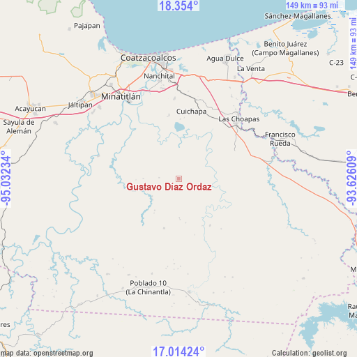
Gustavo Díaz Ordaz GPS coordinates[2]
17° 41' 7.332" North, 94° 19' 45.156" West
| Map corner | latitude | longitude |
|---|---|---|
| Upper-left | 18.354°, | -95.03234° |
| Center: | 17.68537°, | -94.32921° |
| Lower-right: | 17.01424°, | -93.62609° |
| Map W x H: | 149×149 km | = 92.6×92.6mi |
| max Lat: | 32.7° ⇑81.4% North |
| Gustavo Díaz Ordaz: | 17.68537° |
| min Lat: | ⇓18.6% South 14.53588° |
| min Long | Gustavo Díaz O | max Long |
| -117.105° | -94.32921° | -86.73105° |
| W 85.6%⇐ | ⇒14.4% E |
Elevation
Elevation of Gustavo Díaz Ordaz is 39 m = 128 ft, and this is 1214.7 m = 3985 ft below average elevation for this country.
| Max E: |
3497 m = 11473 ft | 85.9% |
| Avg. | 1253.7 m = 4113 ft | |
| Gustavo Díaz Ordaz | 39 m = 128 ft | |
Min E: |
-1 m = -3 ft | 14.1% |
See also: Mexico elevation on elevation.city.
Geographical zone
Gustavo Díaz Ordaz is located in North Torrid zone (between Equator and Tropic of Cancer). Distance of this Northern Tropic circle is 639.5 km =397.4 mi to North.| Distance of | km | miles | from Gustavo Díaz Ordaz |
|---|---|---|---|
| North Pole | 8040.6 | 4996.2 | to North |
| Arctic Circle | 5434.7 | 3377 | to North |
| Tropic Cancer | 639.5 | 397.4 | to North |
| Equator | 1966.4 | 1221.9 | to South |


Nearby cities:
15 places around Gustavo Díaz Ordaz: (largest is in red/bold)
• Adalberto Tejeda
15.6 km =9.7 mi,  138°
138°
• Cahuapan (Anexo Niños Héroes)
35 km =21.7 mi,  222°
222°
• Cuichapa
28.7 km =17.8 mi,  10°
10°
• El Macayal
34.7 km =21.6 mi,  263°
263°
• Emilio Carranza (Salinas)
27.6 km =17.1 mi,  298°
298°
• Fernando López Arias
15.8 km =9.8 mi,  165°
165°
• La Breña
21.6 km =13.4 mi,  196°
196°
• La Concepción
19.1 km =11.9 mi,  353°
353°
• Moloacán
33.4 km =20.8 mi,  356°
356°
• Niños Héroes
33.1 km =20.6 mi,  212°
212°
• Nueva Esperanza
27.3 km =17 mi, 139°
• Nuevo Atoyac
8.5 km =5.3 mi,  248°
248°
• San Cristóbal
26.2 km =16.3 mi, 301°
• San José del Carmen
33 km =20.5 mi,  51°
51°
• Tlacuilolapan
33.3 km =20.7 mi, 12°
Sources, notices
• [Note1] Compared only with cities in Mexico existing in our database
• [Src1] Map data: © OpenStreetMap contributors (CC-BY-SA)
• [Src2] Other city data from geonames.org with taken over terms of usage.
• [Src3] Geographical zone / Annual Mean Temperature by Robert A. Rohde @ Wikipedia
