Nuevo Atoyac geodata
Nuevo Atoyac (Veracruz) is a populated place; located in Mexico in America/Mexico_City (GMT-6) time zone. With population of 867 people, there are 10083 cities with bigger population in this country. Compared to other cities in Mexico, 81.7% of cities are located further ↑North; 85.5% of cities are located further ←West and 87.2% of cities have higher elevation than Nuevo Atoyac. Note1


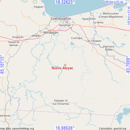
Nuevo Atoyac GPS coordinates[2]
17° 39' 26.964" North, 94° 24' 14.472" West
| Map corner | latitude | longitude |
|---|---|---|
| Upper-left | 18.32623°, | -95.10715° |
| Center: | 17.65749°, | -94.40402° |
| Lower-right: | 16.98626°, | -93.7009° |
| Map W x H: | 149×149 km | = 92.6×92.6mi |
| max Lat: | 32.7° ⇑81.7% North |
| Nuevo Atoyac: | 17.65749° |
| min Lat: | ⇓18.3% South 14.53588° |
| min Long | Nuevo Atoyac | max Long |
| -117.105° | -94.40402° | -86.73105° |
| W 85.5%⇐ | ⇒14.5% E |
Elevation
Elevation of Nuevo Atoyac is 33 m = 108 ft, and this is 1220.7 m = 4005 ft below average elevation for this country.
| Max E: |
3497 m = 11473 ft | 87.2% |
| Avg. | 1253.7 m = 4113 ft | |
| Nuevo Atoyac | 33 m = 108 ft | |
Min E: |
-1 m = -3 ft | 12.8% |
See also: Mexico elevation on elevation.city.
Geographical zone
Nuevo Atoyac is located in North Torrid zone (between Equator and Tropic of Cancer). Distance of this Northern Tropic circle is 642.6 km =399.3 mi to North.| Distance of | km | miles | from Nuevo Atoyac |
|---|---|---|---|
| North Pole | 8043.7 | 4998.1 | to North |
| Arctic Circle | 5437.8 | 3378.9 | to North |
| Tropic Cancer | 642.6 | 399.3 | to North |
| Equator | 1963.3 | 1219.9 | to South |


Nearby cities:
15 places around Nuevo Atoyac: (largest is in red/bold)
• Adalberto Tejeda
20.2 km =12.6 mi,  115°
115°
• Cahuapan (Anexo Niños Héroes)
27.6 km =17.1 mi,  214°
214°
• Cuichapa
33.9 km =21.1 mi,  22°
22°
• El Macayal
26.6 km =16.5 mi,  268°
268°
• Emilio Carranza (Salinas)
23.1 km =14.4 mi,  315°
315°
• Fernando López Arias
17.1 km =10.6 mi,  135°
135°
• Gustavo Díaz Ordaz
8.5 km =5.3 mi,  68°
68°
• Hidalgotitlán
28.6 km =17.8 mi,  296°
296°
• La Breña
17.7 km =11 mi,  174°
174°
• La Concepción
22.8 km =14.2 mi,  14°
14°
• Las Ánimas
33.5 km =20.8 mi,  328°
328°
• Niños Héroes
26.7 km =16.6 mi,  202°
202°
• Nueva Esperanza
31.1 km =19.3 mi, 124°
• San Carlos
32.2 km =20 mi, 274°
• San Cristóbal
22.2 km =13.8 mi, 319°
Sources, notices
• [Note1] Compared only with cities in Mexico existing in our database
• [Src1] Map data: © OpenStreetMap contributors (CC-BY-SA)
• [Src2] Other city data from geonames.org with taken over terms of usage.
• [Src3] Geographical zone / Annual Mean Temperature by Robert A. Rohde @ Wikipedia
