Urecho geodata
Urecho (Querétaro) is a populated place; located in Mexico in America/Mexico_City (GMT-6) time zone. With population of 1,856 people, there are 4680 cities with bigger population in this country. Compared to other cities in Mexico, 71% of cities are located further ↓South; 64.9% of cities are located further →East and 78.8% of cities have lower elevation than Urecho. Note1


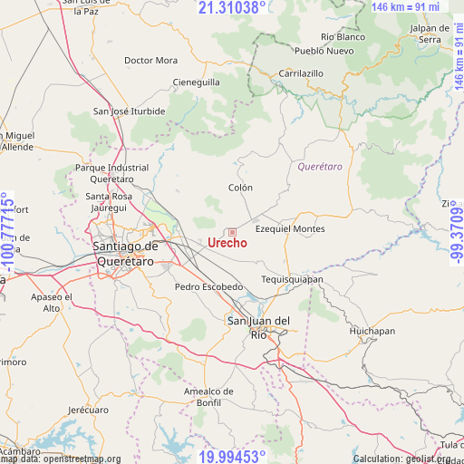
Urecho GPS coordinates[2]
20° 39' 13.968" North, 100° 4' 26.472" West
| Map corner | latitude | longitude |
|---|---|---|
| Upper-left | 21.31038°, | -100.77715° |
| Center: | 20.65388°, | -100.07402° |
| Lower-right: | 19.99453°, | -99.3709° |
| Map W x H: | 146.3×146.3 km | = 90.9×90.9mi |
| max Lat: | 32.7° ⇑29% North |
| Urecho: | 20.65388° |
| min Lat: | ⇓71% South 14.53588° |
| min Long | Urecho | max Long |
| -117.105° | -100.07402° | -86.73105° |
| W 35.1%⇐ | ⇒64.9% E |
Elevation
Elevation of Urecho is 2106 m = 6909 ft, and this is 852.3 m = 2796 ft above average elevation for this country.
| Max E: |
3497 m = 11473 ft | 21.2% |
| Urecho | 2106 m 6909 ft | |
| Avg. | 1253.7 m = 4113 ft | |
Min E: |
-1 m = -3 ft | 78.8% |
See also: Mexico elevation on elevation.city.
Geographical zone
Urecho is located in North Torrid zone (between Equator and Tropic of Cancer). Distance of this Northern Tropic circle is 309.4 km =192.3 mi to North.| Distance of | km | miles | from Urecho |
|---|---|---|---|
| North Pole | 7710.6 | 4791.1 | to North |
| Arctic Circle | 5104.7 | 3171.9 | to North |
| Tropic Cancer | 309.4 | 192.3 | to North |
| Equator | 2296.5 | 1427 | to South |


Nearby cities:
15 places around Urecho: (largest is in red/bold)
• Ajuchitlán
8.2 km =5.1 mi,  43°
43°
• El Blanco
5.5 km =3.4 mi,  211°
211°
• El Gallo
3.3 km =2.1 mi,  58°
58°
• El Nuevo Rumbo
10.9 km =6.8 mi,  23°
23°
• El Tejocote
5.6 km =3.5 mi,  132°
132°
• Esperanza
4 km =2.5 mi,  257°
257°
• Galeras
9.6 km =6 mi,  245°
245°
• Las Cenizas
5.3 km =3.3 mi,  179°
179°
• Los Cerritos
10.3 km =6.4 mi,  173°
173°
• México Lindo
8.9 km =5.5 mi,  201°
201°
• Nogales
8.9 km =5.5 mi,  303°
303°
• Palmas
4.6 km =2.9 mi,  344°
344°
• Purísima de Cubos (La Purísima)
7.5 km =4.7 mi,  217°
217°
• San Francisco
10.2 km =6.3 mi, 217°
• Santa Rosa de Lima
10 km =6.2 mi,  82°
82°
Sources, notices
• [Note1] Compared only with cities in Mexico existing in our database
• [Src1] Map data: © OpenStreetMap contributors (CC-BY-SA)
• [Src2] Other city data from geonames.org with taken over terms of usage.
• [Src3] Geographical zone / Annual Mean Temperature by Robert A. Rohde @ Wikipedia
