La Victoria geodata
La Victoria (Zacatecas) is a populated place; located in Mexico in America/Mexico_City (GMT-6) time zone. With population of 2,487 people, there are 3552 cities with bigger population in this country. Compared to other cities in Mexico, 85.6% of cities are located further ↓South; 78.4% of cities are located further →East and 86.9% of cities have lower elevation than La Victoria. Note1


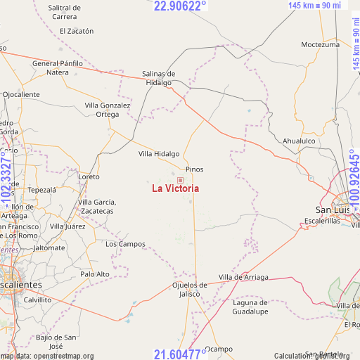
La Victoria GPS coordinates[2]
22° 15' 25.236" North, 101° 37' 46.452" West
| Map corner | latitude | longitude |
|---|---|---|
| Upper-left | 22.90622°, | -102.3327° |
| Center: | 22.25701°, | -101.62957° |
| Lower-right: | 21.60477°, | -100.92645° |
| Map W x H: | 144.7×144.7 km | = 89.9×89.9mi |
| max Lat: | 32.7° ⇑14.4% North |
| La Victoria: | 22.25701° |
| min Lat: | ⇓85.6% South 14.53588° |
| min Long | La Victoria | max Long |
| -117.105° | -101.62957° | -86.73105° |
| W 21.6%⇐ | ⇒78.4% E |
Elevation
Elevation of La Victoria is 2308 m = 7572 ft, and this is 1054.3 m = 3459 ft above average elevation for this country.
| Max E: |
3497 m = 11473 ft | 13.1% |
| La Victoria | 2308 m 7572 ft | |
| Avg. | 1253.7 m = 4113 ft | |
Min E: |
-1 m = -3 ft | 86.9% |
See also: Mexico elevation on elevation.city.
Geographical zone
La Victoria is located in North Torrid zone (between Equator and Tropic of Cancer). Distance of this Northern Tropic circle is 131.2 km =81.5 mi to North.| Distance of | km | miles | from La Victoria |
|---|---|---|---|
| North Pole | 7532.3 | 4680.4 | to North |
| Arctic Circle | 4926.4 | 3061.1 | to North |
| Tropic Cancer | 131.2 | 81.5 | to North |
| Equator | 2474.7 | 1537.7 | to South |


Nearby cities:
15 places around La Victoria: (largest is in red/bold)
• Caballerías (Caballería Villa Hidalgo)
14.6 km =9.1 mi,  350°
350°
• El Chino
7.6 km =4.7 mi,  336°
336°
• El Fraile
12 km =7.5 mi,  291°
291°
• El Nigromante
14.2 km =8.8 mi,  215°
215°
• El Obraje
9.4 km =5.8 mi,  154°
154°
• El Tepetate
16.9 km =10.5 mi,  333°
333°
• Estancia de Guadalupe
3.9 km =2.4 mi,  312°
312°
• José María Morelos
17 km =10.6 mi,  140°
140°
• La Lobeña
8.3 km =5.2 mi,  297°
297°
• La Pachona
11.7 km =7.3 mi,  253°
253°
• Pedregoso
13.2 km =8.2 mi,  267°
267°
• Pinos
7 km =4.3 mi,  52°
52°
• Presa Nueva
14.7 km =9.1 mi,  198°
198°
• Presa de Valenzuela
11.1 km =6.9 mi, 336°
• Villa Hidalgo
14 km =8.7 mi,  322°
322°
Sources, notices
• [Note1] Compared only with cities in Mexico existing in our database
• [Src1] Map data: © OpenStreetMap contributors (CC-BY-SA)
• [Src2] Other city data from geonames.org with taken over terms of usage.
• [Src3] Geographical zone / Annual Mean Temperature by Robert A. Rohde @ Wikipedia
