Mata de Plátano geodata
Mata de Plátano (Michoacán) is a populated place; located in Mexico in America/Mexico_City (GMT-6) time zone. With population of 624 people, there are 13853 cities with bigger population in this country. Compared to other cities in Mexico, 65.6% of cities are located further ↑North; 79.1% of cities are located further →East and 60.5% of cities have higher elevation than Mata de Plátano. Note1


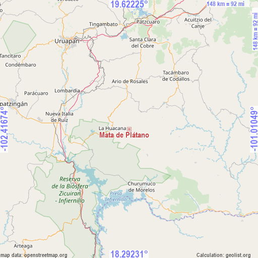
Mata de Plátano GPS coordinates[2]
18° 57' 30.996" North, 101° 42' 48.996" West
| Map corner | latitude | longitude |
|---|---|---|
| Upper-left | 19.62225°, | -102.41674° |
| Center: | 18.95861°, | -101.71361° |
| Lower-right: | 18.29231°, | -101.01049° |
| Map W x H: | 147.9×147.9 km | = 91.9×91.9mi |
| max Lat: | 32.7° ⇑65.6% North |
| Mata de Plátano: | 18.95861° |
| min Lat: | ⇓34.4% South 14.53588° |
| min Long | Mata de Plátan | max Long |
| -117.105° | -101.71361° | -86.73105° |
| W 20.9%⇐ | ⇒79.1% E |
Elevation
Elevation of Mata de Plátano is 972 m = 3189 ft, and this is 281.7 m = 924 ft below average elevation for this country.
| Max E: |
3497 m = 11473 ft | 60.5% |
| Avg. | 1253.7 m = 4113 ft | |
| Mata de Plátano | 972 m = 3189 ft | |
Min E: |
-1 m = -3 ft | 39.5% |
See also: Mexico elevation on elevation.city.
Geographical zone
Mata de Plátano is located in North Torrid zone (between Equator and Tropic of Cancer). Distance of this Northern Tropic circle is 497.9 km =309.4 mi to North.| Distance of | km | miles | from Mata de Plátano |
|---|---|---|---|
| North Pole | 7899.1 | 4908.3 | to North |
| Arctic Circle | 5293.2 | 3289 | to North |
| Tropic Cancer | 497.9 | 309.4 | to North |
| Equator | 2108 | 1309.9 | to South |


Nearby cities:
15 places around Mata de Plátano: (largest is in red/bold)
• Doctor Miguel Silva Macías
23 km =14.3 mi,  356°
356°
• El Cahulote de Santa Ana
19 km =11.8 mi,  46°
46°
• Ichamio
11.6 km =7.2 mi,  266°
266°
• La Ermita (Nueva Jerusalén)
25.3 km =15.7 mi,  59°
59°
• La Huacana
9.9 km =6.2 mi, 272°
• La Huerta
26.2 km =16.3 mi, 53°
• Las Puentes
11.1 km =6.9 mi,  34°
34°
• Los Hacheros
25.4 km =15.8 mi,  36°
36°
• Los Tumines
22 km =13.7 mi, 357°
• Palma de Huaro
26.1 km =16.2 mi,  188°
188°
• Pinal Grande
21.5 km =13.4 mi, 42°
• Poturo
18.1 km =11.2 mi,  144°
144°
• Puruarán
25.3 km =15.7 mi, 52°
• Tavera
19.9 km =12.4 mi, 54°
• Urapa
16.6 km =10.3 mi,  13°
13°
Sources, notices
• [Note1] Compared only with cities in Mexico existing in our database
• [Src1] Map data: © OpenStreetMap contributors (CC-BY-SA)
• [Src2] Other city data from geonames.org with taken over terms of usage.
• [Src3] Geographical zone / Annual Mean Temperature by Robert A. Rohde @ Wikipedia
