Trapiche de Abra geodata
Trapiche de Abra (Jalisco) is a populated place; located in Mexico in America/Mexico_City (GMT-6) time zone. With population of 1,280 people, there are 6771 cities with bigger population in this country. Compared to other cities in Mexico, 68.7% of cities are located further ↓South; 89.5% of cities are located further →East and 53.7% of cities have higher elevation than Trapiche de Abra. Note1


Trapiche de Abra GPS coordinates[2]
20° 32' 22.488" North, 103° 49' 11.172" West
| Map corner | latitude | longitude |
|---|---|---|
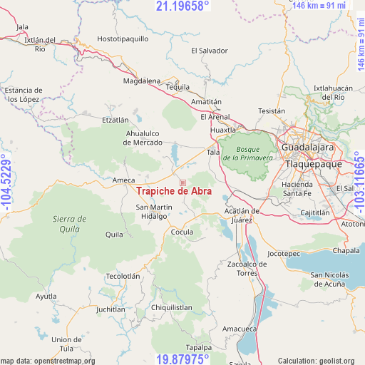
| Upper-left | 21.19658°, | -104.5229° |
| Center: | 20.53958°, | -103.81977° |
| Lower-right: | 19.87975°, | -103.11665° |
| Map W x H: | 146.4×146.4 km | = 91×91mi |
| max Lat: | 32.7° ⇑31.3% North |
| Trapiche de Abra: | 20.53958° |
| min Lat: | ⇓68.7% South 14.53588° |
| min Long | Trapiche de Abr | max Long |
| -117.105° | -103.81977° | -86.73105° |
| W 10.5%⇐ | ⇒89.5% E |
Elevation
Elevation of Trapiche de Abra is 1260 m = 4134 ft, and this is 6.3 m = 21 ft above average elevation for this country.
| Max E: |
3497 m = 11473 ft | 53.7% |
| Trapiche de Abra | 1260 m 4134 ft | |
| Avg. | 1253.7 m = 4113 ft | |
Min E: |
-1 m = -3 ft | 46.3% |
See also: Mexico elevation on elevation.city.
Geographical zone
Trapiche de Abra is located in North Torrid zone (between Equator and Tropic of Cancer). Distance of this Northern Tropic circle is 322.1 km =200.1 mi to North.| Distance of | km | miles | from Trapiche de Abra |
|---|---|---|---|
| North Pole | 7723.3 | 4799 | to North |
| Arctic Circle | 5117.4 | 3179.8 | to North |
| Tropic Cancer | 322.1 | 200.1 | to North |
| Equator | 2283.8 | 1419.1 | to South |


Nearby cities:
15 places around Trapiche de Abra: (largest is in red/bold)
• Ahuisculco
12.6 km =7.8 mi,  75°
75°
• Buenavista
4.6 km =2.9 mi,  313°
313°
• Camichinas
4.9 km =3 mi,  155°
155°
• Castro Urdiales
6.4 km =4 mi,  359°
359°
• Cuisillos
9.1 km =5.7 mi,  31°
31°
• El Amarillo
12.8 km =8 mi,  322°
322°
• El Ranchito (San Isidro)
7.8 km =4.8 mi, 28°
• El Salitre
5.1 km =3.2 mi,  230°
230°
• La Estanzuela
7.9 km =4.9 mi,  210°
210°
• La Sauceda
9.8 km =6.1 mi,  172°
172°
• La Vega
6.3 km =3.9 mi, 320°
• Los Pocitos
12.2 km =7.6 mi,  268°
268°
• Punta de la Vega
10 km =6.2 mi,  304°
304°
• San Juan de los Arcos
12.7 km =7.9 mi,  55°
55°
• San Nicolás
7.9 km =4.9 mi,  179°
179°
Sources, notices
• [Note1] Compared only with cities in Mexico existing in our database
• [Src1] Map data: © OpenStreetMap contributors (CC-BY-SA)
• [Src2] Other city data from geonames.org with taken over terms of usage.
• [Src3] Geographical zone / Annual Mean Temperature by Robert A. Rohde @ Wikipedia
