Sentispac geodata
Sentispac (Nayarit) is a populated place; located in Mexico in America/Mazatlan (GMT-7) time zone. With population of 2,594 people, there are 3420 cities with bigger population in this country. Compared to other cities in Mexico, 83% of cities are located further ↓South; 92.9% of cities are located further →East and 97% of cities have higher elevation than Sentispac. Note1


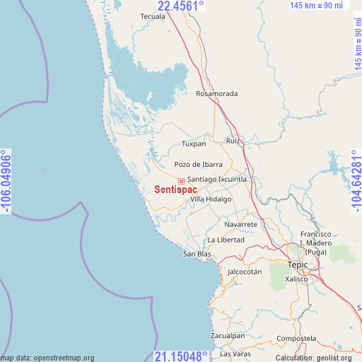
Sentispac GPS coordinates[2]
21° 48' 17.208" North, 105° 20' 45.348" West
| Map corner | latitude | longitude |
|---|---|---|
| Upper-left | 22.4561°, | -106.04906° |
| Center: | 21.80478°, | -105.34593° |
| Lower-right: | 21.15048°, | -104.64281° |
| Map W x H: | 145.2×145.2 km | = 90.2×90.2mi |
| max Lat: | 32.7° ⇑17% North |
| Sentispac: | 21.80478° |
| min Lat: | ⇓83% South 14.53588° |
| min Long | Sentispac | max Long |
| -117.105° | -105.34593° | -86.73105° |
| W 7.1%⇐ | ⇒92.9% E |
Elevation
Elevation of Sentispac is 10 m = 33 ft, and this is 1243.7 m = 4080 ft below average elevation for this country.
| Max E: |
3497 m = 11473 ft | 97% |
| Avg. | 1253.7 m = 4113 ft | |
| Sentispac | 10 m = 33 ft | |
Min E: |
-1 m = -3 ft | 3% |
See also: Mexico elevation on elevation.city.
Geographical zone
Sentispac is located in North Torrid zone (between Equator and Tropic of Cancer). Distance of this Northern Tropic circle is 181.5 km =112.8 mi to North.| Distance of | km | miles | from Sentispac |
|---|---|---|---|
| North Pole | 7582.6 | 4711.6 | to North |
| Arctic Circle | 4976.7 | 3092.4 | to North |
| Tropic Cancer | 181.5 | 112.8 | to North |
| Equator | 2424.5 | 1506.5 | to South |


Nearby cities:
15 places around Sentispac: (largest is in red/bold)
• Amapa
9.7 km =6 mi,  104°
104°
• Campos de los Limones
7.5 km =4.7 mi,  269°
269°
• Cañada del Tabaco
10.6 km =6.6 mi,  184°
184°
• Cerritos
8.1 km =5 mi,  108°
108°
• El Botadero
8.3 km =5.2 mi,  132°
132°
• El Limón
4.9 km =3 mi,  32°
32°
• El Puente
11.4 km =7.1 mi,  63°
63°
• Gavilán Grande
5.5 km =3.4 mi, 96°
• Los Otates
11.6 km =7.2 mi,  195°
195°
• Pozo de Ibarra
9.7 km =6 mi,  44°
44°
• Pozo de Villa
5.2 km =3.2 mi,  54°
54°
• Pueblo Nuevo
5.2 km =3.2 mi, 133°
• Puerta de Mangos
9.7 km =6 mi,  173°
173°
• San Miguel Número Dos (El Quemado)
5.4 km =3.4 mi,  299°
299°
• Valle Morelos
7.7 km =4.8 mi, 58°
Sources, notices
• [Note1] Compared only with cities in Mexico existing in our database
• [Src1] Map data: © OpenStreetMap contributors (CC-BY-SA)
• [Src2] Other city data from geonames.org with taken over terms of usage.
• [Src3] Geographical zone / Annual Mean Temperature by Robert A. Rohde @ Wikipedia
