Amapa geodata
Amapa (Nayarit) is a populated place; located in Mexico in America/Mazatlan (GMT-7) time zone. With population of 2,226 people, there are 3942 cities with bigger population in this country. Compared to other cities in Mexico, 82.9% of cities are located further ↓South; 92.5% of cities are located further →East and 93% of cities have higher elevation than Amapa. Note1


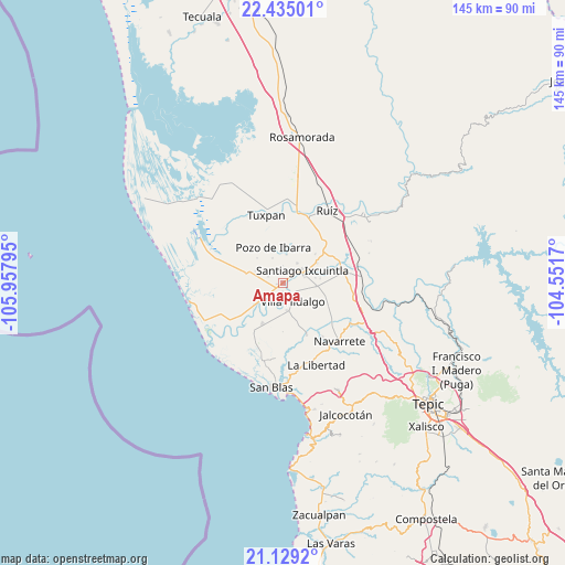
Amapa GPS coordinates[2]
21° 47' 0.924" North, 105° 15' 17.352" West
| Map corner | latitude | longitude |
|---|---|---|
| Upper-left | 22.43501°, | -105.95795° |
| Center: | 21.78359°, | -105.25482° |
| Lower-right: | 21.1292°, | -104.5517° |
| Map W x H: | 145.2×145.2 km | = 90.2×90.2mi |
| max Lat: | 32.7° ⇑17.1% North |
| Amapa: | 21.78359° |
| min Lat: | ⇓82.9% South 14.53588° |
| min Long | Amapa | max Long |
| -117.105° | -105.25482° | -86.73105° |
| W 7.5%⇐ | ⇒92.5% E |
Elevation
Elevation of Amapa is 17 m = 56 ft, and this is 1236.7 m = 4057 ft below average elevation for this country.
| Max E: |
3497 m = 11473 ft | 93% |
| Avg. | 1253.7 m = 4113 ft | |
| Amapa | 17 m = 56 ft | |
Min E: |
-1 m = -3 ft | 7% |
See also: Mexico elevation on elevation.city.
Geographical zone
Amapa is located in North Torrid zone (between Equator and Tropic of Cancer). Distance of this Northern Tropic circle is 183.8 km =114.2 mi to North.| Distance of | km | miles | from Amapa |
|---|---|---|---|
| North Pole | 7585 | 4713.1 | to North |
| Arctic Circle | 4979.1 | 3093.9 | to North |
| Tropic Cancer | 183.8 | 114.2 | to North |
| Equator | 2422.1 | 1505 | to South |


Nearby cities:
15 places around Amapa: (largest is in red/bold)
• Cerritos
1.8 km =1.1 mi,  262°
262°
• Colonia Emiliano Zapata
6.2 km =3.9 mi,  35°
35°
• El Botadero
4.6 km =2.9 mi,  224°
224°
• El Corte
7.1 km =4.4 mi,  171°
171°
• El Limón
9.4 km =5.8 mi,  313°
313°
• El Puente
7.4 km =4.6 mi,  6°
6°
• Gavilán Grande
4.3 km =2.7 mi,  293°
293°
• La Goma
7.8 km =4.8 mi,  195°
195°
• La Presa
5.8 km =3.6 mi,  71°
71°
• Leandro B. Flores
8.6 km =5.3 mi,  95°
95°
• Pozo de Villa
7.5 km =4.7 mi,  316°
316°
• Pueblo Nuevo
5.8 km =3.6 mi, 257°
• Santiago Ixcuintla
5.8 km =3.6 mi,  55°
55°
• Valle Morelos
7 km =4.3 mi,  335°
335°
• Villa Hidalgo
5.3 km =3.3 mi,  152°
152°
Sources, notices
• [Note1] Compared only with cities in Mexico existing in our database
• [Src1] Map data: © OpenStreetMap contributors (CC-BY-SA)
• [Src2] Other city data from geonames.org with taken over terms of usage.
• [Src3] Geographical zone / Annual Mean Temperature by Robert A. Rohde @ Wikipedia
