El Puente geodata
El Puente (Nayarit) is a populated place; located in Mexico in America/Mazatlan (GMT-7) time zone. With population of 788 people, there are 11082 cities with bigger population in this country. Compared to other cities in Mexico, 83.3% of cities are located further ↓South; 92.5% of cities are located further →East and 96.3% of cities have higher elevation than El Puente. Note1


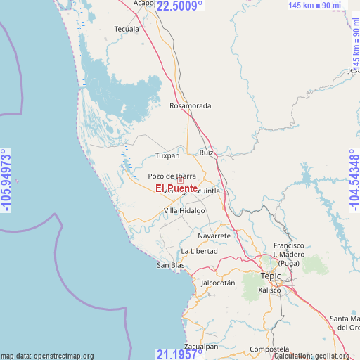
El Puente GPS coordinates[2]
21° 50' 59.244" North, 105° 14' 47.76" West
| Map corner | latitude | longitude |
|---|---|---|
| Upper-left | 22.5009°, | -105.94973° |
| Center: | 21.84979°, | -105.2466° |
| Lower-right: | 21.1957°, | -104.54348° |
| Map W x H: | 145.1×145.1 km | = 90.2×90.2mi |
| max Lat: | 32.7° ⇑16.7% North |
| El Puente: | 21.84979° |
| min Lat: | ⇓83.3% South 14.53588° |
| min Long | El Puente | max Long |
| -117.105° | -105.2466° | -86.73105° |
| W 7.5%⇐ | ⇒92.5% E |
Elevation
Elevation of El Puente is 11 m = 36 ft, and this is 1242.7 m = 4077 ft below average elevation for this country.
| Max E: |
3497 m = 11473 ft | 96.3% |
| Avg. | 1253.7 m = 4113 ft | |
| El Puente | 11 m = 36 ft | |
Min E: |
-1 m = -3 ft | 3.7% |
See also: Mexico elevation on elevation.city.
Geographical zone
El Puente is located in North Torrid zone (between Equator and Tropic of Cancer). Distance of this Northern Tropic circle is 176.5 km =109.7 mi to North.| Distance of | km | miles | from El Puente |
|---|---|---|---|
| North Pole | 7577.6 | 4708.5 | to North |
| Arctic Circle | 4971.7 | 3089.3 | to North |
| Tropic Cancer | 176.5 | 109.7 | to North |
| Equator | 2429.5 | 1509.6 | to South |


Nearby cities:
15 places around El Puente: (largest is in red/bold)
• Amapa
7.4 km =4.6 mi,  186°
186°
• Cerritos
8 km =5 mi,  198°
198°
• Colonia Emiliano Zapata
3.6 km =2.2 mi,  130°
130°
• Cuamiles
8.2 km =5.1 mi,  354°
354°
• El Limón
7.7 km =4.8 mi,  263°
263°
• Gavilán Grande
7.4 km =4.6 mi,  220°
220°
• Heroico Batallón de San Blas
10.6 km =6.6 mi,  54°
54°
• La Presa
7.2 km =4.5 mi,  139°
139°
• Paredones (La Punta de la Laguna)
4.7 km =2.9 mi,  58°
58°
• Pozo de Ibarra
3.9 km =2.4 mi,  299°
299°
• Pozo de Villa
6.3 km =3.9 mi,  251°
251°
• Pueblo Nuevo
10.8 km =6.7 mi, 216°
• Puerta Azul
8.1 km =5 mi,  105°
105°
• Santiago Ixcuintla
5.7 km =3.5 mi, 136°
• Valle Morelos
3.8 km =2.4 mi, 255°
Sources, notices
• [Note1] Compared only with cities in Mexico existing in our database
• [Src1] Map data: © OpenStreetMap contributors (CC-BY-SA)
• [Src2] Other city data from geonames.org with taken over terms of usage.
• [Src3] Geographical zone / Annual Mean Temperature by Robert A. Rohde @ Wikipedia
