Gavilán Grande geodata
Gavilán Grande (Nayarit) is a populated place; located in Mexico in America/Mazatlan (GMT-7) time zone. With population of 932 people, there are 9352 cities with bigger population in this country. Compared to other cities in Mexico, 82.9% of cities are located further ↓South; 92.6% of cities are located further →East and 95.1% of cities have higher elevation than Gavilán Grande. Note1


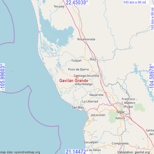
Gavilán Grande GPS coordinates[2]
21° 47' 56.544" North, 105° 17' 34.44" West
| Map corner | latitude | longitude |
|---|---|---|
| Upper-left | 22.45039°, | -105.99603° |
| Center: | 21.79904°, | -105.2929° |
| Lower-right: | 21.14472°, | -104.58978° |
| Map W x H: | 145.2×145.2 km | = 90.2×90.2mi |
| max Lat: | 32.7° ⇑17.1% North |
| Gavilán Grande: | 21.79904° |
| min Lat: | ⇓82.9% South 14.53588° |
| min Long | Gavilán Grande | max Long |
| -117.105° | -105.2929° | -86.73105° |
| W 7.4%⇐ | ⇒92.6% E |
Elevation
Elevation of Gavilán Grande is 13 m = 43 ft, and this is 1240.7 m = 4071 ft below average elevation for this country.
| Max E: |
3497 m = 11473 ft | 95.1% |
| Avg. | 1253.7 m = 4113 ft | |
| Gavilán Grande | 13 m = 43 ft | |
Min E: |
-1 m = -3 ft | 4.9% |
See also: Mexico elevation on elevation.city.
Geographical zone
Gavilán Grande is located in North Torrid zone (between Equator and Tropic of Cancer). Distance of this Northern Tropic circle is 182.1 km =113.2 mi to North.| Distance of | km | miles | from Gavilán Grande |
|---|---|---|---|
| North Pole | 7583.2 | 4712 | to North |
| Arctic Circle | 4977.3 | 3092.7 | to North |
| Tropic Cancer | 182.1 | 113.2 | to North |
| Equator | 2423.8 | 1506.1 | to South |


Nearby cities:
15 places around Gavilán Grande: (largest is in red/bold)
• Amapa
4.3 km =2.7 mi,  113°
113°
• Cerritos
2.9 km =1.8 mi,  131°
131°
• Colonia Emiliano Zapata
8.2 km =5.1 mi,  66°
66°
• El Botadero
5 km =3.1 mi,  172°
172°
• El Limón
5.6 km =3.5 mi,  329°
329°
• El Puente
7.4 km =4.6 mi,  40°
40°
• La Goma
9.4 km =5.8 mi, 168°
• La Presa
9.5 km =5.9 mi,  89°
89°
• Pozo de Ibarra
7.7 km =4.8 mi,  10°
10°
• Pozo de Villa
3.9 km =2.4 mi,  341°
341°
• Pueblo Nuevo
3.4 km =2.1 mi,  209°
209°
• Santiago Ixcuintla
8.9 km =5.5 mi,  79°
79°
• Sentispac
5.5 km =3.4 mi,  276°
276°
• Valle Morelos
4.8 km =3 mi, 12°
• Villa Hidalgo
9 km =5.6 mi, 134°
Sources, notices
• [Note1] Compared only with cities in Mexico existing in our database
• [Src1] Map data: © OpenStreetMap contributors (CC-BY-SA)
• [Src2] Other city data from geonames.org with taken over terms of usage.
• [Src3] Geographical zone / Annual Mean Temperature by Robert A. Rohde @ Wikipedia
