San Nicolás Tolentino geodata
San Nicolás Tolentino (San Luis Potosí) is a seat of a second-order administrative division; located in Mexico in America/Mexico_City (GMT-6) time zone. With population of 659 people, there are 13168 cities with bigger population in this country. Compared to other cities in Mexico, 85.5% of cities are located further ↓South; 70% of cities are located further →East and 50.6% of cities have lower elevation than San Nicolás Tolentino. Note1


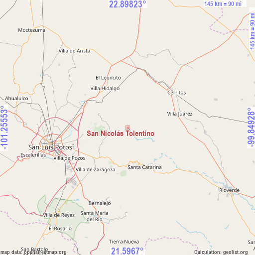
San Nicolás Tolentino GPS coordinates[2]
22° 14' 56.328" North, 100° 33' 8.64" West
| Map corner | latitude | longitude |
|---|---|---|
| Upper-left | 22.89823°, | -101.25553° |
| Center: | 22.24898°, | -100.5524° |
| Lower-right: | 21.5967°, | -99.84928° |
| Map W x H: | 144.7×144.7 km | = 89.9×89.9mi |
| max Lat: | 32.7° ⇑14.5% North |
| San Nicolás Tolentino: | 22.24898° |
| min Lat: | ⇓85.5% South 14.53588° |
| min Long | San Nicolás To | max Long |
| -117.105° | -100.5524° | -86.73105° |
| W 30%⇐ | ⇒70% E |
Elevation
Elevation of San Nicolás Tolentino is 1465 m = 4806 ft, and this is 211.3 m = 693 ft above average elevation for this country.
| Max E: |
3497 m = 11473 ft | 49.4% |
| San Nicolás Tolentino | 1465 m 4806 ft | |
| Avg. | 1253.7 m = 4113 ft | |
Min E: |
-1 m = -3 ft | 50.6% |
See also: Mexico elevation on elevation.city.
Geographical zone
San Nicolás Tolentino is located in North Torrid zone (between Equator and Tropic of Cancer). Distance of this Northern Tropic circle is 132.1 km =82.1 mi to North.| Distance of | km | miles | from San Nicolás Tolentino |
|---|---|---|---|
| North Pole | 7533.2 | 4680.9 | to North |
| Arctic Circle | 4927.3 | 3061.7 | to North |
| Tropic Cancer | 132.1 | 82.1 | to North |
| Equator | 2473.9 | 1537.2 | to South |


Nearby cities:
15 places around San Nicolás Tolentino: (largest is in red/bold)
• Armadillo de los Infante
10.7 km =6.6 mi,  267°
267°
• Cerro de San Pedro
25.7 km =16 mi,  262°
262°
• Corcovado
21.8 km =13.5 mi,  318°
318°
• Estación Ventura
27.4 km =17 mi,  304°
304°
• Joya de Luna
24.6 km =15.3 mi,  32°
32°
• La Concordia
12.4 km =7.7 mi,  344°
344°
• La Parada del Zarcido
24.2 km =15 mi,  219°
219°
• La Redonda
23.7 km =14.7 mi,  334°
334°
• Pedrera del Tanquito
26.3 km =16.3 mi,  306°
306°
• Peotillos
27.9 km =17.3 mi,  347°
347°
• San José de Gómez
21.4 km =13.3 mi,  228°
228°
• Santa Catarina
24.3 km =15.1 mi,  157°
157°
• Veinte de Noviembre
20.3 km =12.6 mi, 335°
• Villa Hidalgo
25.9 km =16.1 mi, 329°
• Xoconoxtle
23.3 km =14.5 mi, 224°
Sources, notices
• [Note1] Compared only with cities in Mexico existing in our database
• [Src1] Map data: © OpenStreetMap contributors (CC-BY-SA)
• [Src2] Other city data from geonames.org with taken over terms of usage.
• [Src3] Geographical zone / Annual Mean Temperature by Robert A. Rohde @ Wikipedia
